2020-04 April
FGCC rides in April 2020.
Saturday 4th April – 08.00am ride
PT, MA, CB, KBS, ZA, TK, RT, JB
- Paul
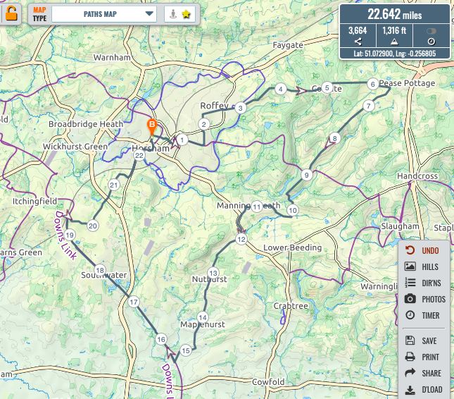
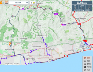
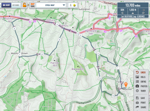
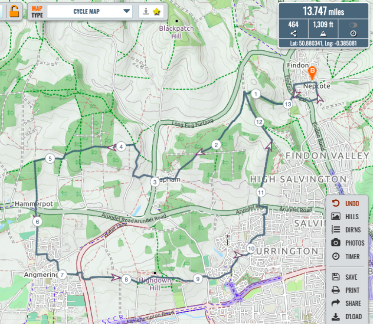
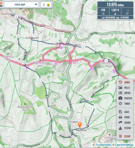
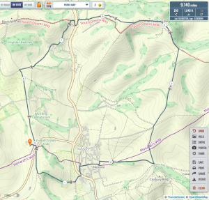
Starting under grey skies, I headed through the town and south via Sedgewick to Copsale on deserted roads, crossed the Downslink and continued south to West Grinstead. Took A272 to the Orchard, and was passed by only 2 vehicles. Then north on Downslink back to Horsham.Satmap says 15.1 miles and 252 feet
Plotaroute site (pictured) says 15 miles and 748 feet
Paul’s ride to West Grinstead - Mark
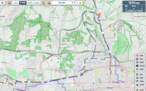
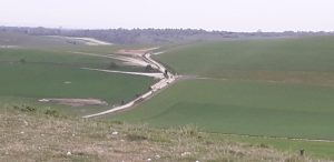
My ride this morning took me via the usual Dapper’s Lane/Swillage Lane route into APE continuing northish between upper and lower Barpham farms over Barpham Hill the right to Lee Farm then left up to Chantry Post.Along the SDW to the Downslink, down that to Old Shoreham where I collected the packages for Julie then back across the old bridge, through the airport to the seafront.Along that to the Sea Lane cafe in Goring(closed), to Ferring via the Ilex Way, left after the level crossing to the A259band back home via by byway up the side of Angmering bypass to The Spotted Cow (closed) and Weavers Hill.
A total of 30.5 miles and 1270 ft according to my app.
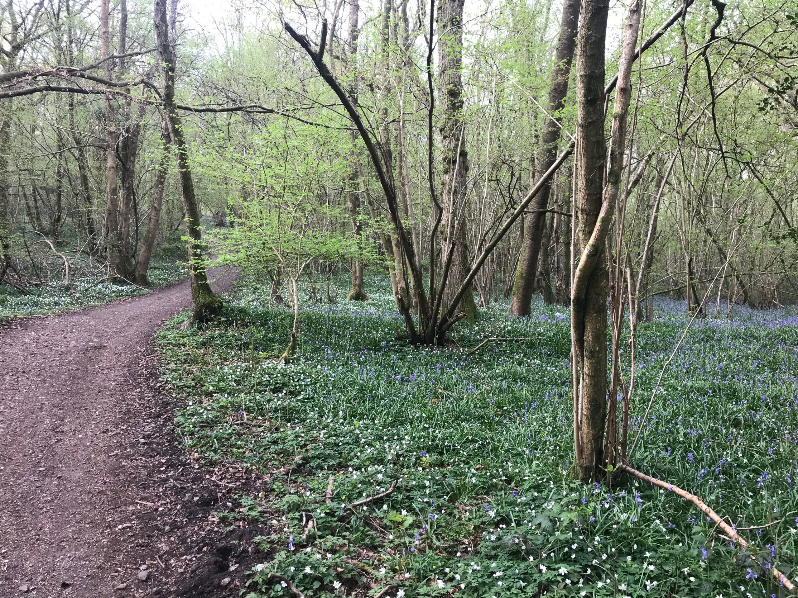
Mark’s ride to Shoreham for emergency collection - Chris.The Italian wing, currently still present in Sussex, took a route from Findon climbing Church Hill and then down through Clapham Woods to see the early flush of the spring Bluebells. From there I climbed into Patching and cutting through Angmering Park I came out at Hammerpot. From here I made my way through Angmering village, climbing Weavers Hill and continuing on to Highdown. From there a decent to the environs of Durrington Tesco and then up to climb Cote street continuing on to the junction with Chichester Hill where I met Mr Richard Thomas and subsequently Kirsten and one of the Bang-Sorensen girls. The four of us stood around keeping at least 2 metres apart for a short chat before realising that we may be a ‘gathering’. So I started the decent down the now very fast Church Hill decent back to Findon followed at a Corona safe distance by Mr Thomas. We separated at the A24 for me to return to Findon via Nepcote Lane. I didn’t use any technology but by my old style speedometer said that I had covered 14 miles.

Chris’s ride to Highdown - Kim.
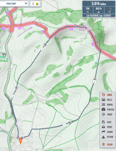
I took my usual morning loop on my trusted K2, leaving 6:30 towards Monarch’s Way, followed it until I turned right towards Southdowns Way. Reaching Kithurst, I turned left (the other right) and continued on Southdowns way until my favourite Broooom bridle way to my left.
At the end of this bridleway I climbed the hill and went into APE, here I followed Monarch’s Way and ended up in Patching. As it was still very early, I went through my lovely Clapham Wood, that turned out with no bluebells but plenty of white anemones. Didn’t meet any on my ride through Clapham and was back home at 8:45. Don’t have a clue of mileage but enjoyed my early morning ride.

Kim’s ride - ZachRode over to Rustington to deliver supplies to No.1 Son et fam – Findon Valley, Offington Lane, The Plantation, Tesco-Durrington, Yeomans – Toyota, A259 past Asda-Ferring and Sainsbury-Rustington; Mill Lane, Worthing Road to 23 Bleinheim Drive.Returned by much the same route except continued on A259 E past Yeoman’s-Toyota to next roundabout (by Centenary House). L past Durrington Health Centre, continuing up Durrington Hill; crossed A27 to climb Salvington Hill, where Le Peloton (Margaret & self) divided: M carried on down Bostal to A24 and thus back to Cherry Cottage, whilst – in order to enjoy a short section off-road (and, thus, hopefully enable ride to be registered in the Bulldog Bling stats!) – rode up Honeysuckle Lane from the top of Salvington Hill and continued along the track to where it meets Long Furlong, thence A280 back to Findon … Margaret recorded just < 28kms; I guess that perhaps I did c.30kms ..
Zach’s emergency parcel delivery ride - Tim.Tim’s brief report: Chanctonbury .. then west to north farm .. just got home
Tim’s late ride 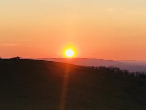
Sunset from Chanctonbury - Richard.
I was out and my route was via Muntham, taking the path through the woods to the east-ish of the farmhouse through the woods and then cutting up to join the usual route to the High Barn, over to Kithurst Hill and then Kim’s “vroom” route down to Lee Farm and back up to Chantry Post. Then return home via Church Hill at the top of which I came across Kim’s wife and daughter as well as Chris.The two ladies had been out for their daily walk, which now includes picking up rubbish for which they are to be highly commended. We all agreed that it is incredible how much rubbish is dropped even on paths and especially on roads, and particularly how disgusting is the behaviour of dog-owners hanging up “poo-bags” on trees, almost leading to a discussion on Tim’s much desired project.
13.7 miles and 1,253 ft.
Richard’s ride - Jake. 11miles and 1,129ft
Jake’s ride


Saturday 11th April – Nepcroft trek ‘n Brek
CB, PT, KBS, ZA, JB, MA, RT.
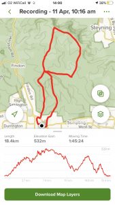
- CB. I ventured out this morning for a warm Easter ride. I headed towards buddington bottom and up to chantonbury heading down the northern side towards the lands where ‘only the hardy go’. From there I headed east back towards the South Downs way but before reaching it I took an unmarked ‘Kim’ track that was ‘very interesting’ (including a tear in my jacket) before picking up a footpath to Washington. From Washington across the a24 by the church and then following bridleways through to Sullington barn cafe (closed). From there I followed the lane and then the a283 into Storrington where I bought a sausage roll and tea to take away. Leaving the village I found a spot to quietly consume my provisions and then took chantry lane and after a bit the steep bridleway up to Sullington hill. From there the normal route back to Findon taking in church hill. Route and stats (metric I’m afraid) attached – 21km and 441 metres of gain. Satmap 14 miles and 1,581 ft.
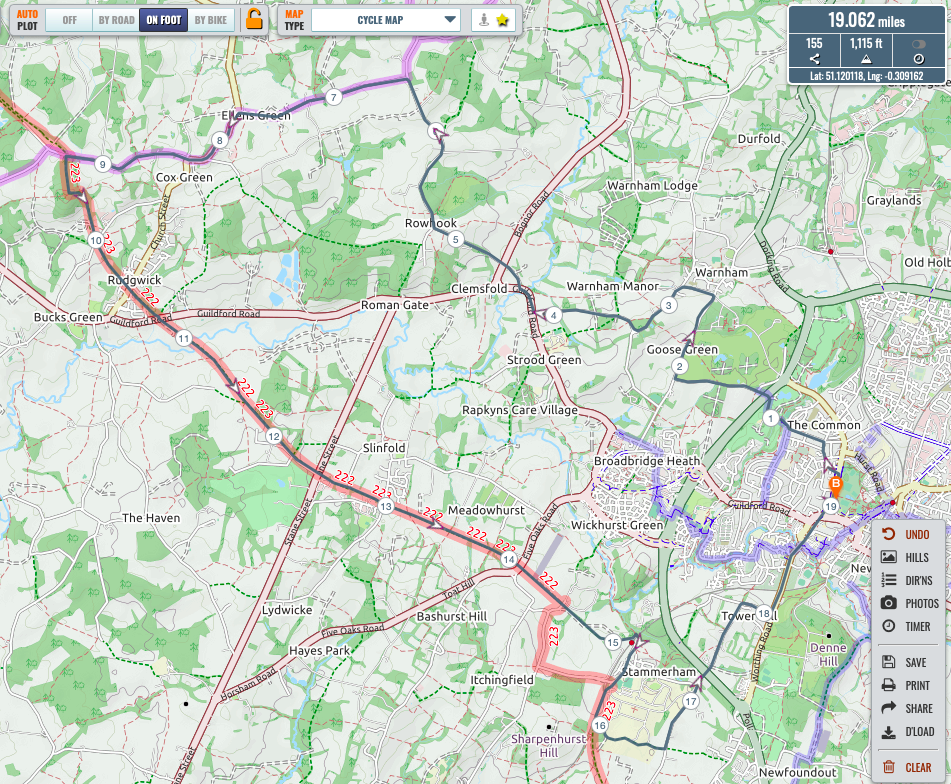
Chris’s route - PT. Indeed a fine morning for a ride. I escaped from Horsham via an underpass beneath the bypass, and headed up to Warnham, then westward to Rowhook and Ellens Green and down Baynards lane to pick up the Downslink at the north end of the tunnel. Climbing the hill I admired the bluebells
 then followed the Downslink to and through Christs Hospital (note new route through the station). Turn left where the Downslink exits the grounds of the school to cross the school grounds and emerge on Two Mile Ash road then north and into Horsham. 19miles and 1,115ft.
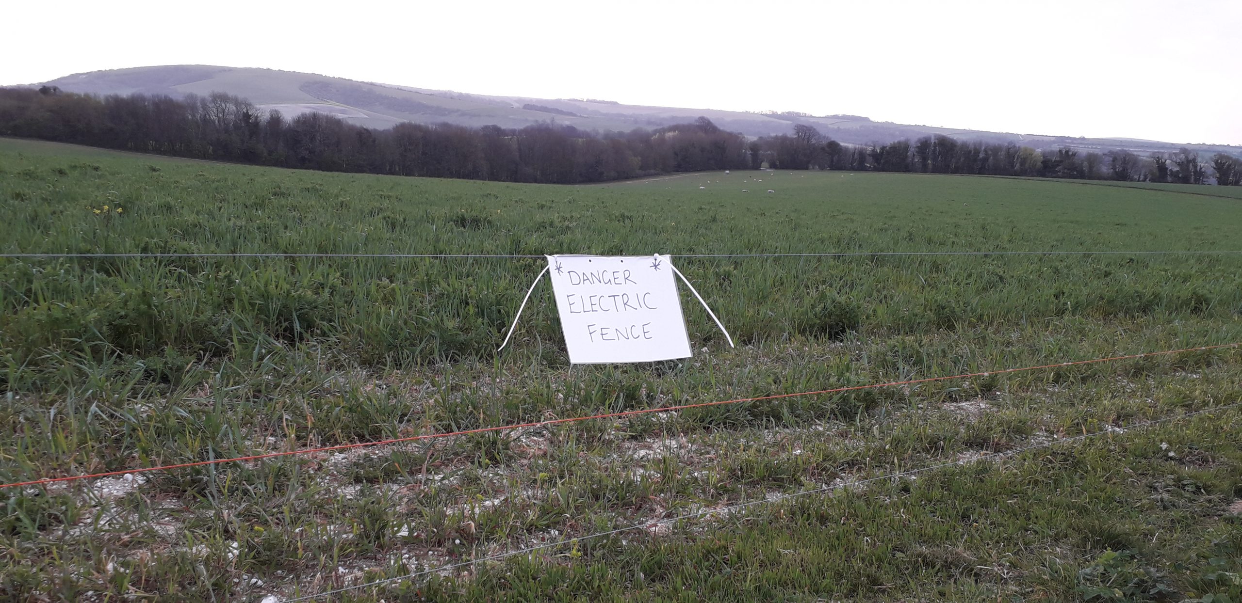
Paul’s route - KBS. I took my usual morning loop, setting out at 7am. However, a massive flock of sheep on Monarch’s Way, blocked my normal route.
 Hence, I headed north and soon reached Southdowns Way. At the pucka place I noticed this fellow.
 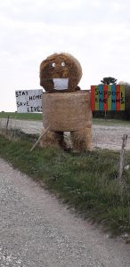 I had the Southdowns way totally for myself, o ly two cars at the car park but no people to see. After a while I turned left on my Brroom route, oh so dry and so fast. At the end I climped the hill and went into APE where I picked up Monarch’s Way. Out of the totally dry APE I noticed two elderly lady riders waiting on their horses at the gate into Patching. As Clapham now is closed even for me, i shouldn’t that way. However, as member of the FGCC I did open the gate for them. Back home after climbing the last steep hill up to Long Furlong – as the farm people were still working with the sheep on the Farm – arriving 8:30. Please tell me how the farmer knows that Mr. Budd hasn’t returned to Italy as planned?
 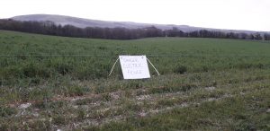 Happy Easter to you all.
 - ZA. Route taken this a.m. -> Cissbury Ring c/p -> crossed Steyning-Sompting Rd -> Church Fm, Coombes; -> Botolphs -> Downslink, N. taking longer route to pass safely beneath A283 alongside R.Adur, and thence to Bramber Roundabout: Maudlyn Lane -> Sopers Lane/’Concrete Road’ -> Langmead Memorial; SDW -> jn. with top of ‘Llama Lane’, -> down to Buddington Bottom -> Gallops Fm -> Stable Lane -> Nepcote Lane and return to Cherry Cottage. c.2hrs -30 mins (lingering awhile in both Coombes and Botolphs* churchyards).
- JB. My usual ride with only two paracetamol and not three this time. 11miles and 1,129ft
Jakes route - MA. I was indeed out this morning. After the usual homage to the 10 minute rule, I dropped down through Rustington to the seafront, along to Littlehampton, up the river and over the pedestrian bridge, thence along Ferry Road and down the restricted byway to Climping Beach to view the sea defence repair works, still ongoing. After an little exploration of the footpaths around the cafe there (closed) rode up through Yapton to Binstead whereupon I took the spectacular Old Scotland Path until it finishes at Binstead Lane just south of the A27. Not wishing to cycle on that road I headed south again past Hanger Down House to Ford Road, up that and through Arundel to the cafe by the bridge (closed) and back past the station and up the hill to turn left on Crossbush Lane. Cycled all the way down to the A27, along the footpath until it ended, along the A27 (I had to give in to it at this point) for v short distance then left up Blakehurst Lane. After about 250yds, I turned right onto the bridleway that took me through APE as far as Patching Hill, then down dog-shit alley, down The Street and France Lane to Arundel Road. Deciding that the weather was too nice to return home yet, I turned left, went under the A27 and via the bridleway along Pot Lane to Highdown Hill, thence by the bridleway back the The Spotted Cow (closed) and Weavers Hill to home.
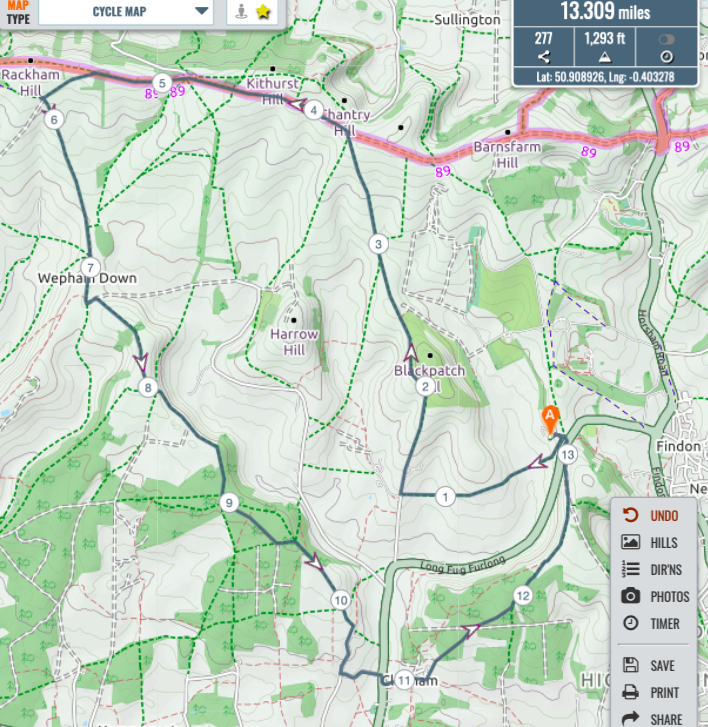
- RT. I was also out for a ride yesterday morning, this time an Amberley loop ride but taking Mark’s suggestion of the descent of Amberley Mount via the left turn at Rackham Mount. Mark, what an excellent find – great view with a lovely secret valley below and huge vineyards all the more special due to the quiet with no aircraft noise and just the birds. Amazing to think that I have passed by that turning all these years without any idea of its existence.
My route was out via Muntham taking the track through the woods to the east of the house again. Interestingly there were quite a few obstacles across the path including tyres and fairly large tree trunks moved there deliberately. On to High Barn, SDW, Amberley Mount as already described and the return via North Stoke , up to SDW and then back to Findon via Church Hill. Noticeably increased numbers of riders out, including a group of 4 adults clearly not of the same family.Total 17.82 miles and 1,553 ft climbed.
- AM. Road bike. Down to the seafront along to the Halfbrick( now some kind of residential thing)
Along the seafront to Ferring. Through Ferring to East Preston returning on the A259 cycle path to Durrington, up through Durrington to the A27 up the valley cycle path and through the village home. Did the same ride last Sunday, Tuesday and Friday.19.7 miles - TK. Not a ride but potentially a TAMIT:
I didn’t ride yesterday, but did venture out on good Friday with Claire on a non qualifying dual e-bike ride . We rode up school hill and across the field just west of the roundabout towards collarbone alley. as you observed We encountered some barriers around Muntham and a hostile horse rider .. pronouncing ‘can’t you read – go home’ , when I enquired why she didn’t go home I was told ‘ I have to exercise my horse ‘! . the encounter ended with a polite suggestion that the lady should perhaps get off her ‘high horse’ ..We enjoyed the rest of our ride up to SDW, lee farm, over the mound along the ridge at barpham and into patching wood returning via monarchs way.


TAMIT – See TK above
Saturday 18th April – 08.00am ride
CB, KBS, RT, PT, AM, ZA, MA.
- CB. Today I ventured out of Pulborough for the first time since Tuesday, with an objective a. Taking my bike to AD cycles in Horsham and b. Having a ride.After repairs a few weeks ago I was experiencing new movement in the bearings of my bike frame and I had arranged with Andy who had preciously made repairs to see the bike at 8:30 before the shop opened.I parked in Southwater and took the downs link for a short run until I had travelled under the A24. Turning left on bridleway I followed the mainly off-road route to Horsham parish church and on to AD cycles. After 10 minutes Andy has made good his precious work and i headed out through the town, across Rookwood Golf course and out to warnham. From the village I took threestile road and then Mayers lane and northlands road. Whence I turned onto a bridlepath heading towards warnham Manor. From the manor bridlepath to farlington school and then into Nowhurst Lane. Following the lane until it became bridleway and then riad I arrived at the church in Slinfold and headed into the Downlink. Navigating the new section at Christ’s Hospital (very nice) i proceeded back to Southwater.Total: 18.2miles and 906ft
Chris’s ride Great to find a new route and explore in these lockdown times!
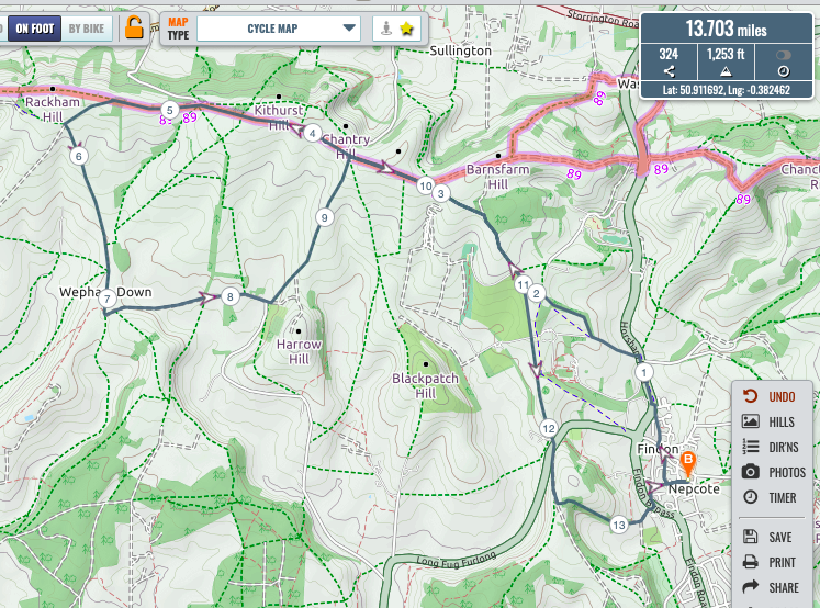
- KBS.I did go out yesterday at 7:30 and took – what we here in the house call – the easy-peasy route:Crossed Long Furlong and up Honeysuckle lane until Church hill where we (The Flying Brit and his – less flying – wife) turned left. At the bottom we bumped into the Team Chaplain who had left his wife back home doing Zumba in support of our Memorial Artist’s daughter.After a nice chat (with the legal two meters distance) we said goodbye to the Team Chaplain and continued through Findon and and went up to Cissbury where we turned left and rode towards Chantonbury.” src=”blob:https://fgcci.org/27419d82-9036-4017-8dda-a8e27b416c91″ alt=”20200418_090006.jpg” class=”inline-image-global inlined-image-cid-9dfc9b29-3ee4-456c-abec-8a2504cf4382 Apple-web-attachment Apple-edge-to-edge-visual-media Singleton” style=”width: 1117px; max-width: 800px;”>Slightly spooky at the top of ChantonburySteady climb up to the peak and continued towards A24 with the detour midway to the right over the field and through the valley. Crossing A24 and back home via Windlesham.Went also out today where my front inner tube exploded less than 200 from home :-(. Total: 9.1 miles and 1,040 ft.
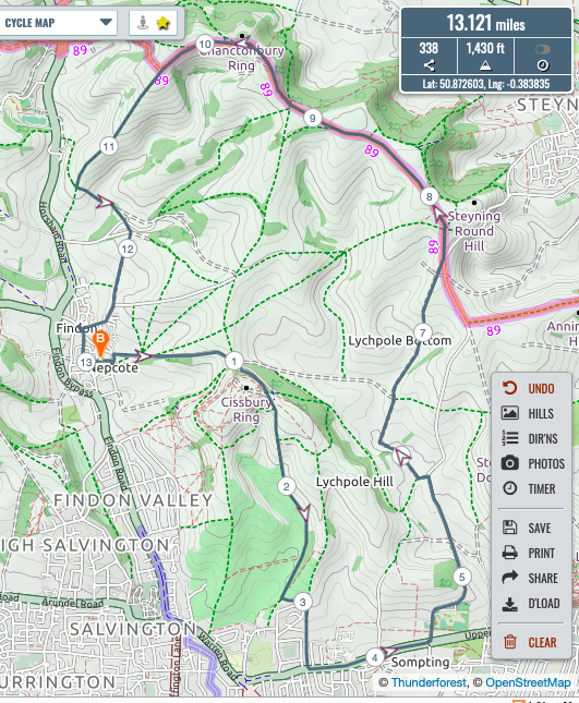
Kim’s easy peasey route - RT. I headed off east up and round Cissbury and then down the east side of the golf course to the A27. Then in to Halfords to try to buy some blasteet repair sheet (yes one new thing that I do like to purchase) but it was too early. Onto the A27, which was almost a pleasurable experience because for this short section I had the road to myself, and then left into the Sompting Estate.
Onto Litchpole Farm and then the track up to Langmead, meeting young Jake heading in the opposite direction on the track near the top of the concrete road. A 10 minute or so stop for a chat accompanied by the song of a skylark almost just above us. From Langmead to Chanctonbury, then down towards the A24 with a left turn to take me to the Findon Park house drive and then up via Gallops Farm to return to Findon by Stable Lane.
Total 13.1 miles and 1,430 ft.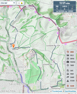
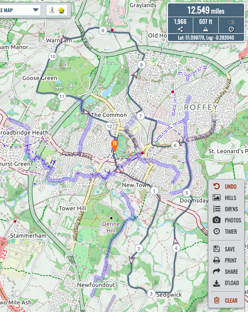
Richard’s route - PT. I was indeed out at the appointed hour (actually the ancient appointed hour of 07:30), and narrowly missed running into Mr Budd as I also passed by A D Cycles at about 07:35 (and wondered why the lights were on). My route was down south through the town toward Copsale, before doubling back at Sedgwick to take Doomsday lane. Passing between Horsham proper and Roffey, I headed out to Warnham and then re-entered Horsham via the golf course. Altogether 12.5 miles and 607 feet according to Plotaroute.

Paul’s route - AM. Road Bike: To the seafront via Findon valley etc. To Shoreham beach on the seafront into a stiff N.Easterly.Back along seafront, along to Ferring rapidly with a following wind. Up sea lane along to Goring through Durrington up the valley home. Total: 23.6 miles and 620ft.
Andy’s road route - ZA. I encountered Kim & Kirsten whilst making my way towards Rogers Farm.
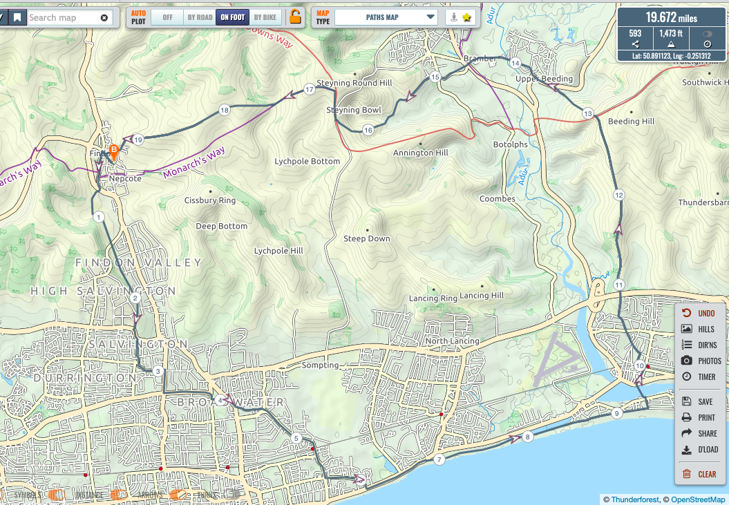
Continued down Findon Valley Gallops, Mill Lane, Half-Moon Lane, Ashacre Lane, Offington Lane, Broadwater St E., Dominion Rd, Brougham Rd and thus onto Seafront: Thence to Ferry Rd, Shoreham, crossing foot/cycle bridge, passing Parish Church of St Mary de Haura, into Shoreham High St, over level crossing, L turn after Ravens Rd, Rt into Mill Lane, up Mill Hill crossing bridge over A27 up towards Truleigh Hill: at jn where SDW ascends from Adur Valley took Bridleway down towards Upper Beeding, onto road passing The Towers School, and R at r’abt into High St, U/B.Crossed river into Bramber thence returning via Maudlyn Lane, Sopers Lane, Concrete Rd, Langmead, Monarch’s Way to No Mans Land, bearing R to ascend steep hill bringing me out at top of Gallops Jn.M had had a call from Angus asking if I could effect a delivery, so headed for Village. stores, and thence back to Cherry Cottage. Total: 19.7 miles and 1,473 ft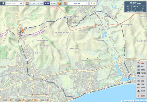
Zach’s route Great to be out, as always, tho much looking fwd to being able to ride en Peloton once again, and talk b&#£@“)s 😊
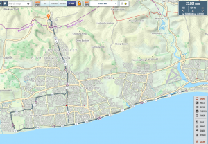
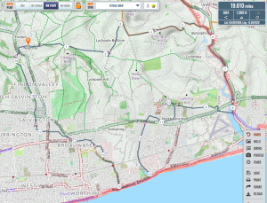
- MA.I was also out yesterday and if I say so myself, rather excelled myself.Leaving on the dot of 08:00, I followed the same route as last week to LIttlehampton, Climping Beach, Yapton, Avisford and Binstead to cycle the length of Old Scotland Lane again, definitely worth a re-visit. In fact so enamoured was I that I turned the wrong right at the end and was past Tortington Manor before I realised this so I retraced my route and shock horror, used a rather nice footpath reminiscent of Ilex Way across to SW Arundel.At the A27 roundabout I took the bridleway up the back of the hospital all the way to cross the A29 at Rewell Hill then up the road to Madehurst to take the bridleway through Partletts Farm up to the SDW west of Bignor Hill. East along the SDW past Toby’s Stone to Westburton Hill and Bury Hill, across the A29 (again) and the Arun, past the Amberley Tap and up to the foot of Amberley Mount. Rather than climb that, I turned right along the bridleway half way up then right again which took me down to Peppering High Barn. Through Burpham and Wepham to Warningcamp Hill, past Blakehrst Farm then along the bridlepath just short of the A27 through APE to Patching to the Old Arundel Road then home via Dappers Lane.A wonderful ride of 38.76 miles and 2145ft accent according to my app but I attach the GPX file for the Team Cartographer to apply the official corrections (which were later confirmed as 37.7 miles and 2,641 ft).
- JB. I did my old faithful usual ride from the golf course up to Cissbury ring then across to Chanctonbury down to the Langmead memorial and then back to Cissbury and home……. Total 11.4 miles and 1,129ft.

Jake’s route


Saturday 25th April 08.00am ride
RK, CB, TK, PT, MA, AM, RT
- RK
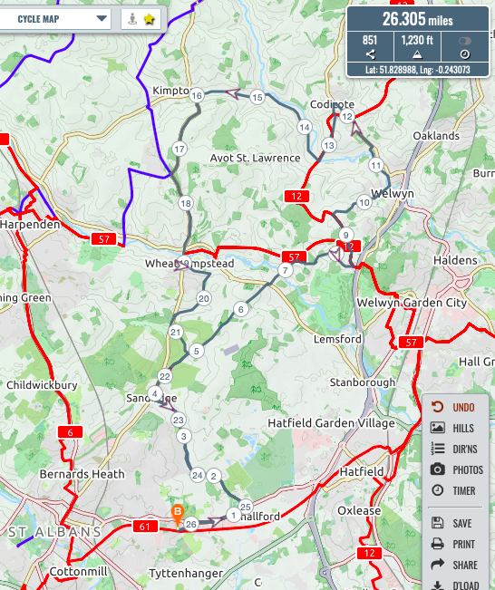
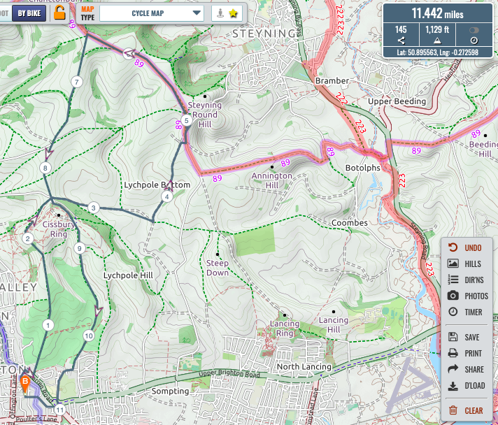
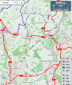
I am pleased to say that I too was out on a ride today, HOWEVER, here starteth the debate:1) I was on a road bike, but there is no mention of the type of steed in FGCC.2) I was out with my good lady and there is certainly mention of Gentlemen in FGCC.I think there may be a need for a V-EPM (Virtual) or SD-EPM (Social Distancing) or SAH-EPM (Stay At Home), to discuss the rules once again.Strava says 26 miles and 926ft climb. (Satmap 25.3 miles and 1,230 ft
I’m missing my therapy sessions once a week.
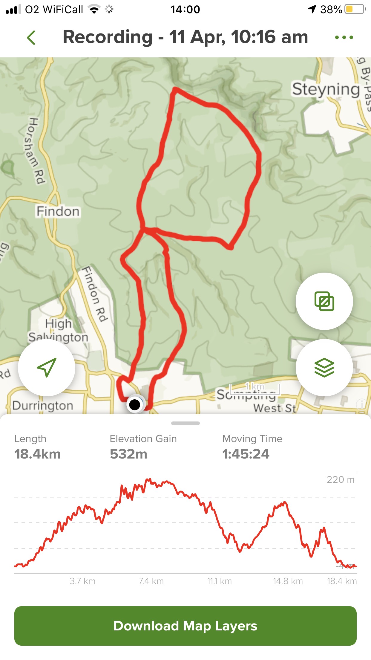
Roy’s road ride - CB. I headed out at about 8 o clock, leaving Findon and headed up to High Barn where some dry ground needed repair. While stopped Tim and his e- trainer arrived followed soon afterwards by the Team Vicar. We exchanged some words and then Tim and Clair left Zach and I to exchange a few more words. We left High barn together but separated at the car park. I continued along the Southdowns way and then headed up to the not tank through the now dense undergrowth.
And after the gallops where the path splits to the Budd finger memorial, I turned left and climbed into Angmering Park woods. Following through the woods I took the main tracks to arrive at myrtle grove and then on to Tolmare. Then to the top of church hill and down church hill to Findon. Wanting a little more I cycled through the village from south to north and then up the path climbing from the oval to stable lane. Up stable lane to the bridleway that cuts behind the stables and out to Nepfield.
In all 26km with 395m climbed. Weather improving all the way.
Chris’s ride - KBS. I went out today at 7:30, also with a personal trainer, headed towards Southdowns Way, however, we took the Windlesham route to climb Chanctonbury Ring from A24. Reaches the top (on my middle ring) while Kirsten had to walk the last climb. Back home via General Bottom’s Valley, Gallop Farm, Findon (where we met Mr. Roche and one of his dogs. Not to miss the bluebells, we climbed Church Hill on our way home. Difficult to catch my dear wife when she races up Church Hill 😂😂😂. 8.9miles and 1,119ft
Kim’s route - ZA. I ventured up in the direction of the high barn where it joins via the bridleway across the field and through woods to N of Muntham Farm. As has already been reported, there I encountered TK + personal trainer (Mrs K on e-bike) conversing with CB.
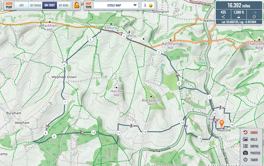
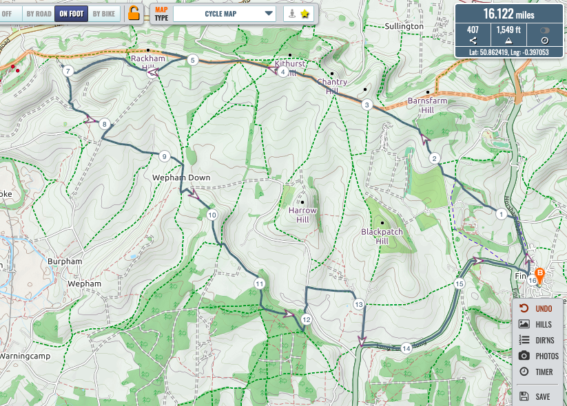
After some pleasant conversation, went our separate ways – I continued W on SDW as far as jn at Rackham Banks: turned L then R to follow track running W (more or less parallel with, but slightly S of SDW where it begins to descend Amberley Mount (spectacular valley on my left below the vineyard where I believe RT rode recently): turned L down steep descent into said valley and up steep ascent towards The Burgh; turned left, then shortly after Rt, and then left in order to take track across to Wepham Down, and thus up to Barpham Hill: then along track on edge of escarpment above Lower Barpham from which spectacular view to be enjoyed from bench given in memory of one, Patricia Sherlock, 1912 -2007: thence into Michelgrove Park (Angmering Park Estate Woods) onto Patching Hill. Turned left to head down to jn where Long Furlong Lane meets Long Furlong from where I rode up LF back to Findon (c.3 hrs) What a lovely day to be out (tho tad chilly first thing): great to (not) meet other Gentlemen – like others, greatly looking fwd to the day when we are able to convene en Peloton, faff a little, talk b*&£#@)(s and share a Brek.
Until then, great to read other Gentlemen’s accounts of their adventures 🚴♂️ Total: 16.1 miles and 1,549ft.
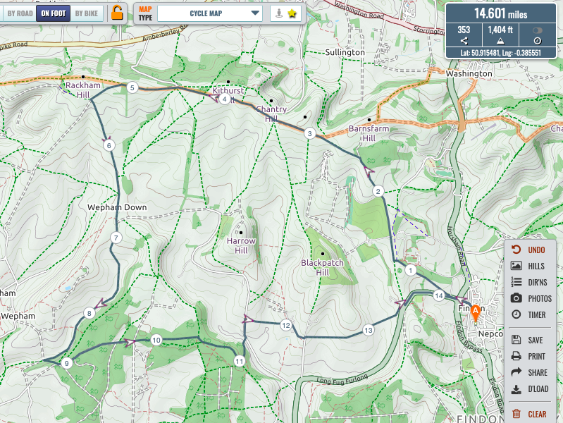
Zach’s route - TK. A nice ride today .. TK on ‘whyte’ accompanied by ‘e’personal trainer .. leaving at 8.09, heading up school hill and across fields to collarbone alley .. up to SDW , where it was great to bump into Mr Budd and subsequently team vicar.. after brief discussions went our separate ways ..With improving weather now apparent . personal trainer drove me on to Rackham hill, down the whoosh whoosh , along gallops to end of angering park .. joining end of treees to see bluebells.
Proceeded back through full length of angering park to Mitchellgrove , myrtle grove and monarchs way to tolmare , returning to Findonia.
Arrived home ahead of 10.00.. apparently 15.5 miles. Satmap 14.6 miles and 1,404 ft
Scrambled eggs , marmite on toast etc in garden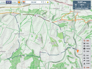
Tim’s route - PT.
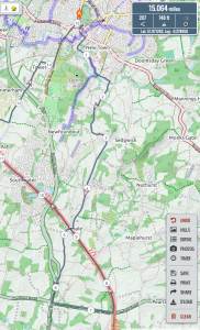
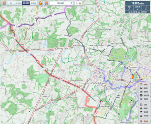
I was also out this morning, for a predominantly road circuit taking in (nearly) Pease Pottage and Copsale, returning to Horsham on the Downslink. Unsupported by personal trainers of either bionic or natural flavour, I enjoyed a companionable silence without the companion.
Noted a repurposing of the village phone box in Nuthurst as a lending library before taking a bridleway through Joles Farm and joining the sunny Downslink just north of A272
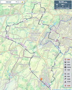
plot says 22.6 miles and 1316 feet.Maps of my and Tim’s rides attached.Looking forward optimistically to riding en peleton before the summer ends!
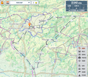
Paul’s route -
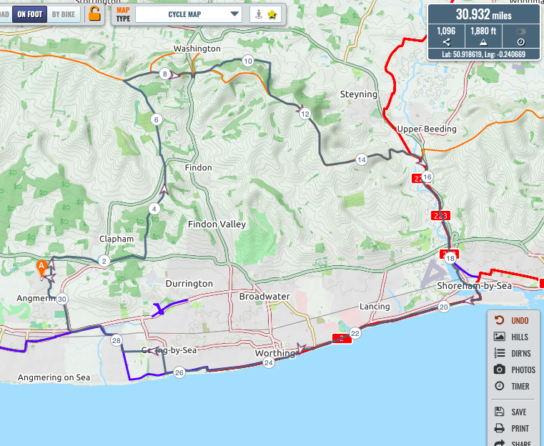
MA. I set out from home in Angmering by way of Holt Farm up through Clapham Woods, Church Hill and Collarbone Alley to the High Barn.I thence turned East and took the SDW to nearly half way up the North face of the Eiger where I took the first Bridleway off the the left through the woods past Owlscroft Barn towards Kim’s favourite farmer, up llama lane to the SDW again thence along to the Downslink and down to Shoreham and across the bridge to Shoreham Beach. Along the beach to the SeaLane Cafe inland for a bit the along Ilex way to Ferring and along the A259 and up the byway beside Angmering bypass to The Spotted Cow and thence home.
gpx file attached but my App says 31.74 miles and 1283ft. Satmap 30.9 miles and 1,880 ft

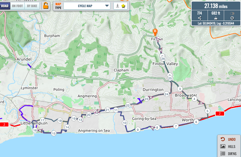
Mark’s route - AM. Road bike: Findon Valley to Worthing Seafront
at The old Aquarena.Along seafront to Ferring up to the A259. Along to Angmering, Rustington, down to Littlehampton seafront.
Along the seafront to the river then up through the town and through Rustington, East Preston, Goring, Durrington to the A24 at Offington. Up Findon Valley , home. Sea a bit choppy, south easterly wind quite cold but not a real problem. Beautiful sunshine. 27.2 miles and 682 ft.

Andy’s route - RT. Another ride out east with a mission to make a collection for building work en route. Up to Cissbury and straight on, turning left on the gravel track north of Litchpole farm up to the top of the concrete road and onto the SDW. Past Belsen for bacons and down to the Downslink. Onto the footbridge at Shoreham with a short stop for a Doc Martin-style change of clothing faff due to mist lifting. Up the track alongside Lancing college towards the Lancing Hill car park, but taking a track off to the left just before it to avoid a mass of people on the main bridleway. Got a bit lost in what turned out to be a nature reserve (oops!) and eventually found the road down to North Lancing (Beafeater or similar pub) and then west parallel to the A27 to Halewick Lane and across at the lights. Lights were against but there was no traffic so I was able to simply go across the pedestrian crossing without waiting. Down to and along the coast as far as Ham road (former Half Brick pub). Past East Worthing stn and right into Southdownview rd for my collection (long queue spaced at 2m so it was about a 20 min stop), then through the residential area to Broadwater Green and across to Offington Avenue. On to Salvington and our usual route home via the Gallops. However, at the wooded section just off Mill Lane I thought I would take the upper route in order to avoid people, only to get scratched heavily as it is quite overgrown as well as finding that everyone else had the same idea. Dropped down to the main track and found that there was no one on it! Total 19.6 miles and 1,186 ft.
Richard’s route - JB. Usual Saturday ride.
Jake’s route