2020-05 May
FGCC rides in May 2020
(FGCC ride to France 8th-12th May and Tank Memorial ride 16th May cancelled due to the coronavirus pandemic). Individual rides recorded whilst restrictions are in place.
Saturday May 2nd 08.00am ride
TK, MA, CB, AM, ZA, RT, JB
- TK.
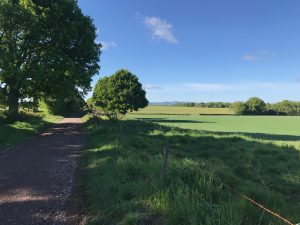
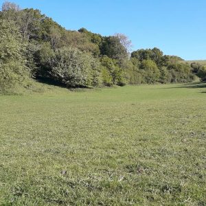
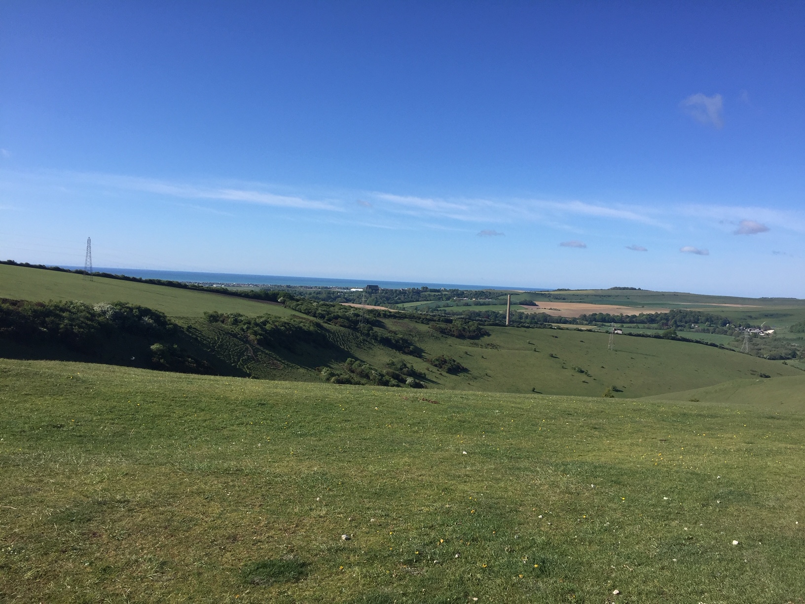
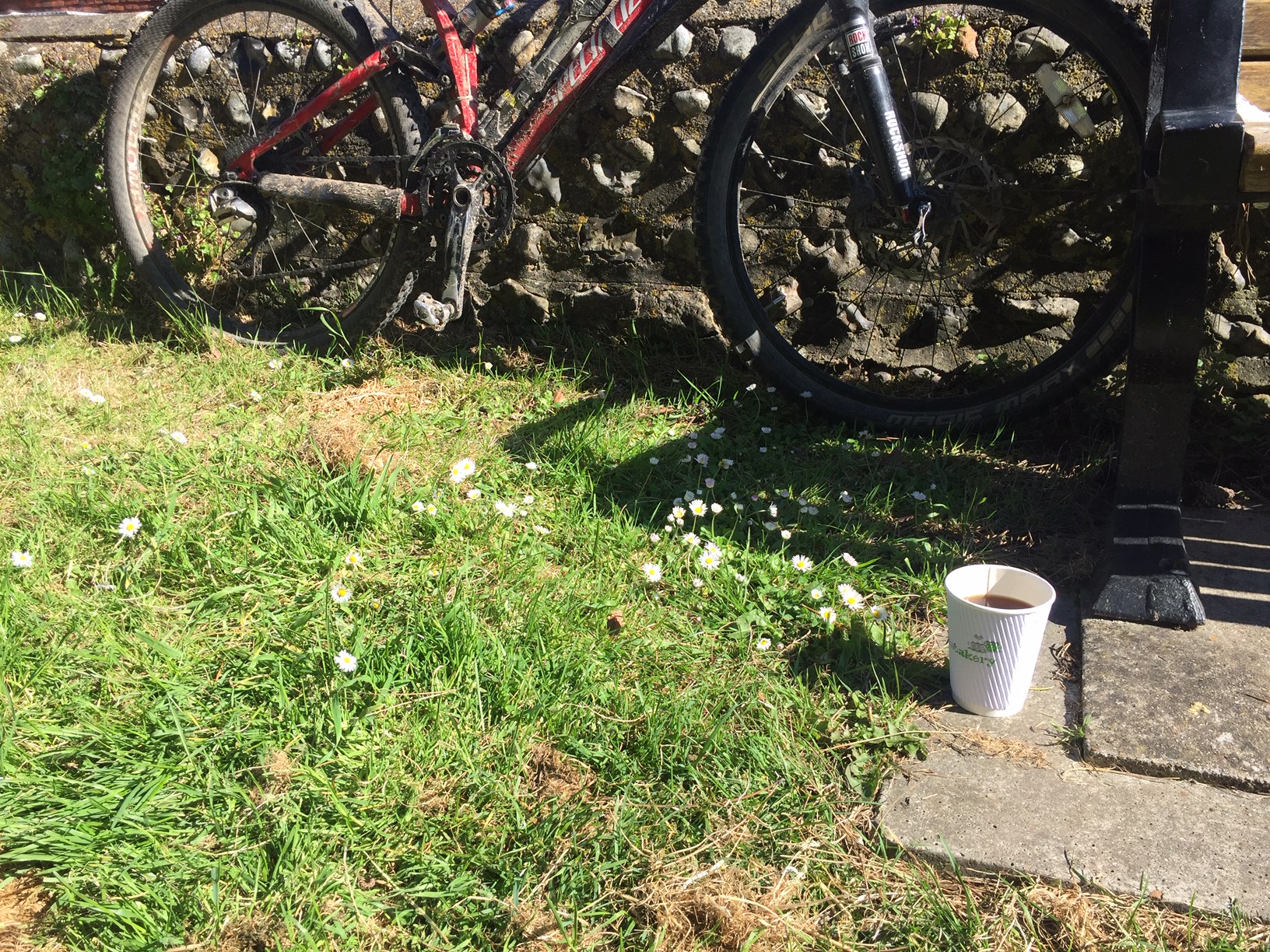
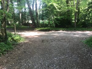
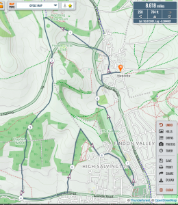
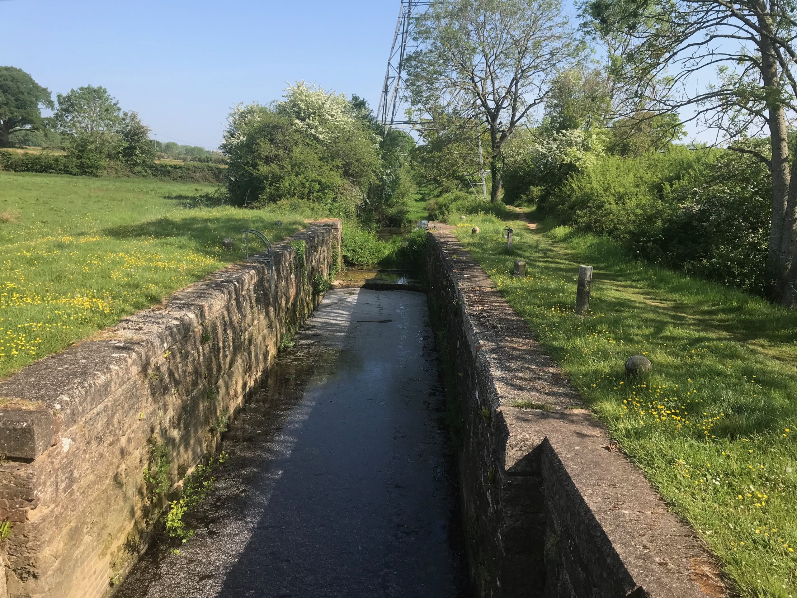
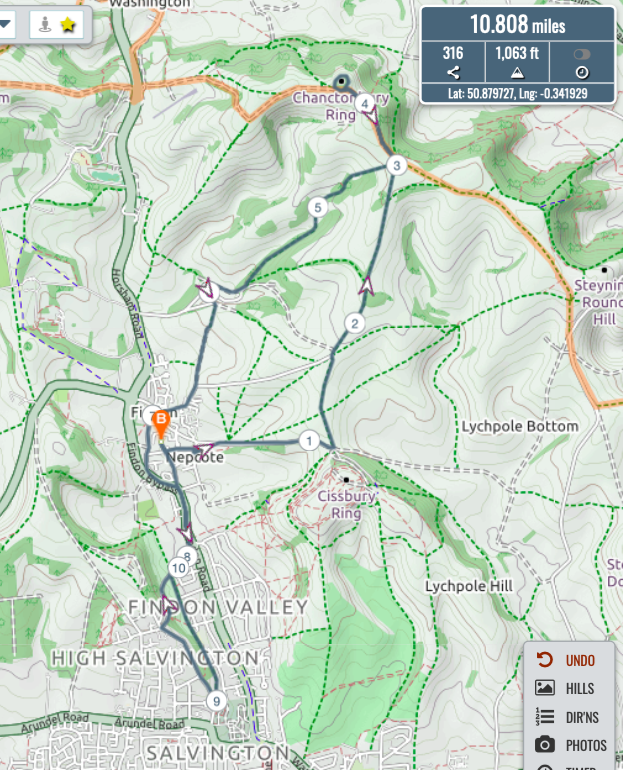
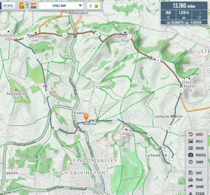
This morning I ventured out again , this time accompanied by two personal trainers on their respective e-bikes.Our route took us to cisbury and straight on to the cheeky hilette just before the Steyning bostal road turning left to slowly make our way towards langmede.. mid way on this track we bumped into Jake ( non e-bike) and stopped for a brief conversation ..We then headed up to langmead to SDW to chanctonbury descending through the old chalk pit and back to SDW to windlesham ..
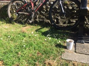
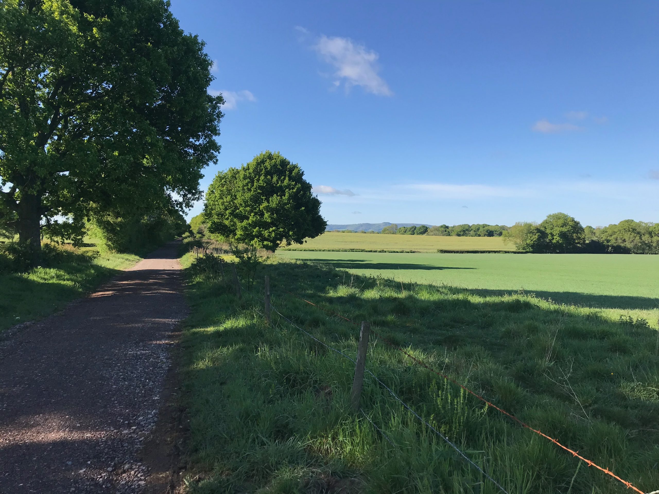
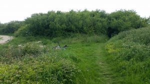
Midway through woods at Windlesham we had a minor mechanical .. see photo ..
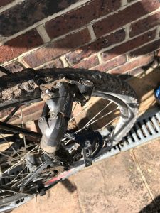 with derrailiure removed from the wheel Claire and I to return home to Findon to fetch the car to recover Hannah .. who had made her way to windlesham bridgeapprox 11 miles and possibly 1300 feet climbing .. (Satmap 14.6 miles and 1,404 ft)
Home for cooked breakfast and to cut Claire’s hair ….
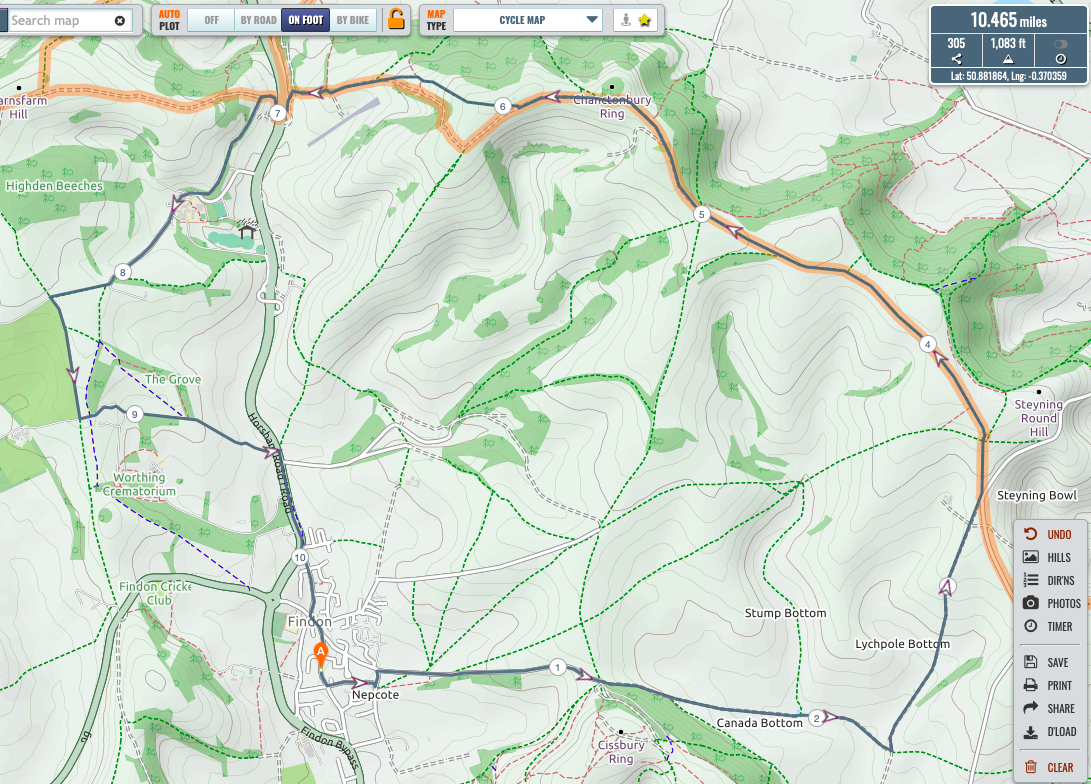
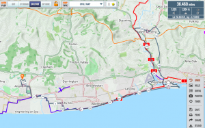
Tim’s derailleur failure route - MA. This morning I wanted to explore north west of Arundel some more so I decided to use some of that deadly tarmac stuff got get there as directly as possible, path along the A27 then the old A27 to Crossbush and back on the A27 again (well the footpath anyway) until the 2nd roundabout.I took the same bridleway NW as I did last week NW that goes through Rewell Wood and drops down to the A29, right along Fairmile bottom until a bridleway off the the left took me up to join the Monarchs Way through Houghton Forest then up to the SDW and west along the SDW to Graffham Down where upon I turned left.I followed the bridleway and byway as far as Postles Barn, at which point I suffered a Kim moment and instead of continuing along the lovely byway, I turned left up a bridleway and through the trees and dropped down into East Dean. Took the bridleway south along Eastdean Hill to Selhurstpark Road; made (in)famous during FGCC Monarch’s Way rides; then on to the bridleway and Monarchs Way to Whiteways Cafe (closed).At this point I paused my tracking app, giving myself a stern reminder to start it again before I set off after a snack or three. Of course, I set off again without restarting it so at this point Paul, you need to pay attention!I dropped down to Houghton along the Monarchs Way and turned right and followed the path along the river to South Stoke, a quick look at the beautiful church then continued on the bridleway to the road above Offham. At this point I realised the app wasn’t tracking so after swearing a bit and pressing the start button, I took the road down to Arundel, left over the bridge to the A27 and followed the same route home.My app says 29.58 miles but I await the official complete distance and ascent from the Team Cartographer. (Satmap 30.9 miles & 1,880 ft).
Mark’s route - AM. Road bike. Down the valley through Durrington to the A259. Along to R/about past Rustington Sainsburys. Left past the wind mill pub and Right at the r/about. Through Rustington to the Body Shop r/about.Rejoin A259 and proceed over the Arun to Ford R/about at eClymping. Left here past Clymping school and back towards Littlehampton along the road to Rope Walk. Right just before Arun footbridge and down to the sea. Brief pause to enjoy the view then back to the footbridge, along LA seafront through Rustington, Angmering and East Preston to Ferring. Down SeaLane Ferring,
along the seafront into Worthing to the new Pool at Splash point. Back through the town and Broadwater to the Offington R/about, up the valley to Findon and home. Into a s/westerly on the way out but wind at my back on the homeward leg. Plessant sunshine and a thoroughly pleasant ride. 31.2 miles on my clock.(Satmap 32.3miles & 722ft)

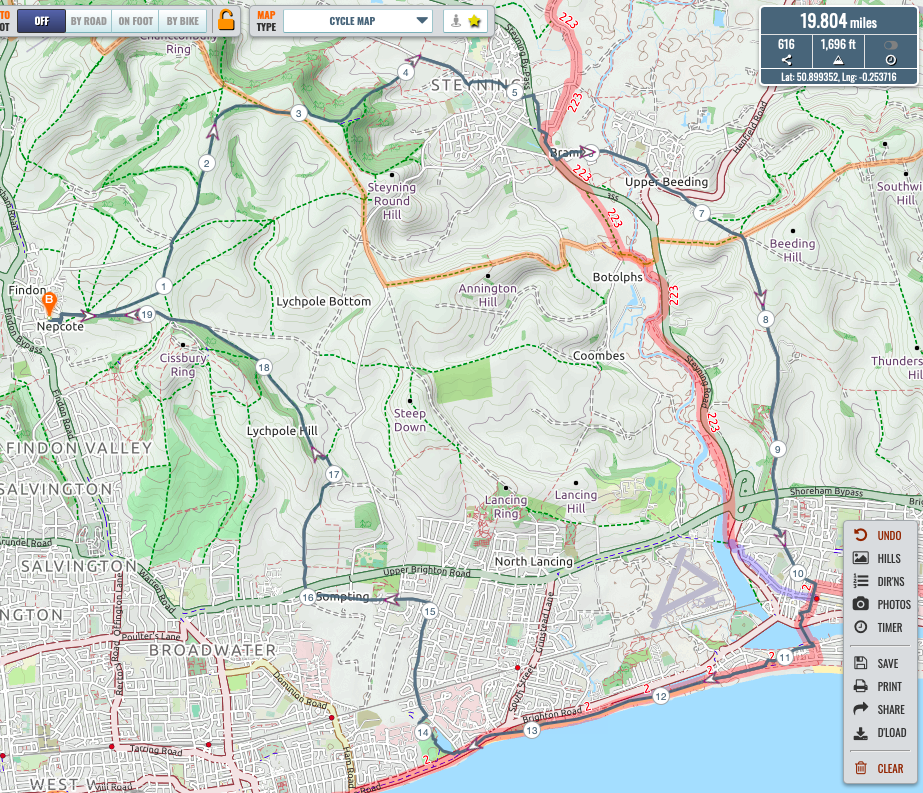
Andy’s route - CB. I too ventured out, with only a casual plan in mind – general direction. I headed out towards Cissbury but taking the bridleway to the left of the lane up to the track joining Cissbury and Chanctonbury. Taking the track toward Chanctonbury and then to the right to join the Southdowns Way heading East. Turning left off the Southdowns way into the Kim woods for a steep drop down near the jumps and onto mouse lane in Steyning. Down into the town and the left at Church Lane to pass the school and then the church, over the bypass and into Roman Road to Bramber. Through bramber and then Upper Beeding, past the Towers and onto the North Face climb to Truleigh Hill. At the junction with Mill lane I took a snap..

 Down through the town, across the bridge and then along the coast past the lagoons. As the path got busier I went up through Brooklands park and then up to sompting village. Through the village and then onto a lane leading to sompting park estate. Following on and through towards the farm but taking the left up through the fields leading to the northern flank off Cissbury. And then the descent back to Nepfield.All in 33km with 488m of climbing. (Satmap 19.8 miles & 1,696 ft)
Beautiful morning and ride.
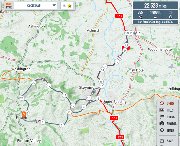
Chris’s route - ZA. Met Richard in Nepcote Lane – RT intent on heading out to Lea Fm: my route took me up to Cissbury c/p, continuing E until meeting of ways where turned L up the track which eventually meets Sompting-Steyning Rd where Concrete Rd descends Steyning Bowl: took later down thru Upper Maudlyn Fm, Sopers Lane and Maudlyn Lane down to Bramber R’bt. Following signs for Downslink, N Castle Lane/Roman Way/Kings Lane and thus to D’link. -> Henfield via series of footpaths/‘twittens’ that eventually bring you into High St & ‘Truffles’. Encountered the TM enjoying a takeaway coffee who kindly minded my steed whilst I procured refreshment for self. TM having attained his designated destination rather more quickly than planned (steed currently shod with fine pair of ‘Continental’ slicks) he was keen to embark on his return journey to Horsham whilst I took my coffee + breakfast pastry to Tanyards, delightful little oasis with a pond along one of Henfield many cut-throughs.
Return via D’link, Goring Rd (Steyning), Bostal Rd, Langmead Mem., SDW, Gallops …
A lovely day for taking ‘time to stand and stare’ which I did several times on return leg.(22.5 miles & 1,896 ft)
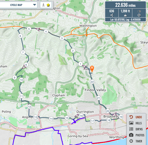
Zach’s route - RT. I wanted to head out west for a change but also needed to make another collection in East Worthing. Met ZA as already reported in Nepcote Lane for a short chat, then up School Hill and across the field just up from the roundabout to the top of the crematorium, along collarbone alley and to Kithurst Hill. Then the Flying Brit’s “vroom” track to the top of the gallops. Up to the trig point and then the second of Kim’s “vroom” routes albeit somewhat slowly due to the sticky conditions caused by the recent rain. East along the road and a right to take me all the way down to Dover Lane. A short section of a very quiet A27 then past Avery Towers (well almost) and through Angmering taking our usual route to Highdown. Across Titnore Lane and a generally easterly route to Broadwater Industrial estate for the collection. Back via Broadwater and straight up the A24 as I thought it would be quieter than my experiences of the gallops last week.
Total 22.82 miles and 1,310 ft(Strava). 22.6 miles & 1,398 ft (Satmap).
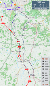
Richard’s route - PT. My route took me south through Horsham and along the Peddlars Way to join the Downslink at Copsale. From there I rode south to the Orchard where I passed under the A272 and entered a half mile section where the track is under renovation. Coronavirus having caused the workmen to retire from the fray, the track is a softish cementitious slurry a la Digginwell lane, but only an inch or two deep. traversing this stretch I passed through Partridge green and sighted Chanctonbury in the distance.
View of Chanctonbury from Downslink Continuing south I reached Henfield and repaired to Truffles for a Tea and restorative nibble.
Here I met the Team Chaplain, entirely by chance and in no way a premeditated rendezvous, of course.After a brief and correctly socially-distanced chat, I departed north for a road ride back through Shermanbury, Partridge Green, Littleworth, Maplehurst, Nuthurst and Mannings Heath. Tarmac is getting a bit tedious, even on road tyres! Total 24.2 miles & 1,171 ft).
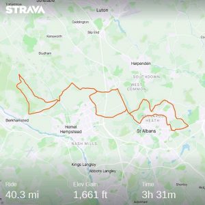
Paul’s route - RK. Total 40.3 miles & 1,661ft.
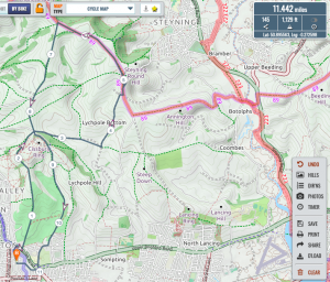
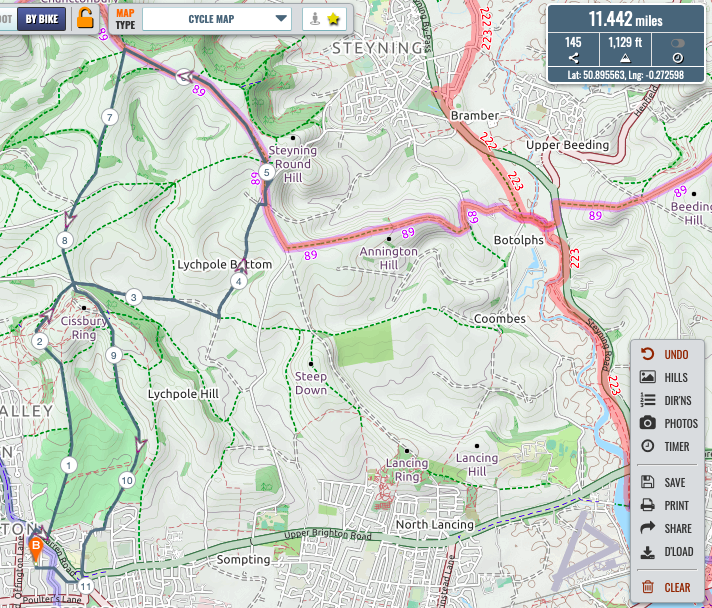
Roy’s route - JB. Total. 11.4 miles & 1,129ft.
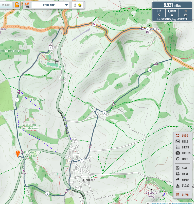
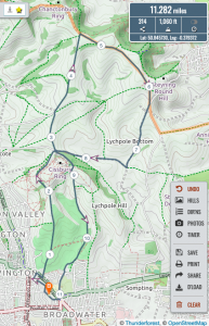
Jake’s route - KBS. Rather late I can add that I too went out last Saturday although only with one personal trainer. We went on our usual loop, leaving at 7:30 towards South downs way but took the Windlesham School route to climb Chantonbury Hill from A24. After the long climb (me on my middle ring) we got to the top and enjoyed a fantastisc view. After that we went home via the beautiful Buddington Bottom valley (which I think we should do more often).
Buddington bottom At the end of the valley we took the steep climb up to Gallop Farm and headed down to Findon. Last climb of the day was up Church hill. Back home 9:30. Total 8.9 miles and 1,119 ft.

Kim’s route


TAMITS: TK – award for extraordinary courage required in cutting Mrs K’s hair?
PT – The Flying Dane “too much tarmac” award for an excess of tarmac during the lock-down?
Saturday 9th May 08.00am ride
PT, KBS, CB, RT
- PT.
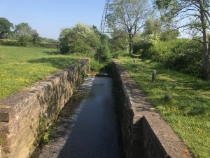
On such a fine morning, what can lift the spirits but to recall the rich history of navigation in our county, and how better to celebrate this glorious heritage than to enjoy the virtually traffic-free linearity of Stane Street, then cross and re-cross the Wey and Arun canal.
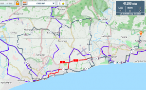
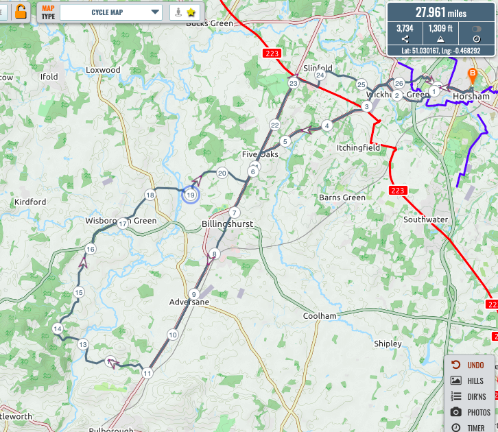
I departed Horsham and progressed southeast to cross the Downslink and join the roman road at Five Oaks. Continuing along the line of the road I passed through Billingshurst and turned right after the Toat cafe to follow a part od Mr Budd’s route over the canal and past Pallingham Quay. Continuing as far as the end of the track up through Stopham Woods, I tarried awhile and at 09:15 left an uplifting message for the Budd contingent
“FGCC woz ere” and continued on my way west through the wood to rejoin the road. Turning north I passed through Wisborough Green then northeast to Newpound Common where I took a bridleway east to re-cross the canal at a sadly disused lock.
 Back on to the roman road and north to join the Downslink for a bit before finally returning to Horsham through Broadbridge Heath.A super round trip of about 2 hours 45 mins, covering 27.9 miles and 1309 feet.
It seems my inscription in Stopham woods went unnoticed, however.

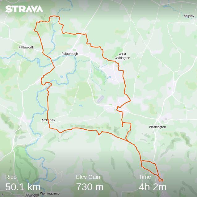
Paul’s route - CB. Route plan sent prior to ride as follows: Leaving Findon at 8ish and heading to the not tank where I will hang out for 10 mins or so until about 8:55. From the tank along to Amberley mount to descend into Amberley village taking the back path down towards Coldwaltham.From there to the White Hart at Stopham bridge where I will take a 10 min break on the benches by the river. Then up through Stopham and Stopham woods to arrive at the Arun crossing at Pallingham Quay Farm. Across to brewers Hill and then up and across to Nutborne lane. Down through Nutborne lane and then stream lane to west chiltington then on southlands lane to the bridleway connecting to northlands lane in sullington. Then to Truffles in Storrington for tea and a bite to eat which I shall enjoy by the river just to the west of village centre. I’ll stay there for about 10 mins and then sullington lane to go back over the downs to findon.The route plan says it is 31 miles with 2100 feet of climbing and that it will take a tad over 4 hours so 5 allowing for my planned stops.
Chris’s route - KBS.
Just back from a terrific loop following Chris (with suitable social distancing). 75 % on footpaths when off-road partly following Chris’ running route.
If Chris should write an updated version of our ride, don’t believe that he had to wait for me on the second half of our ride. Don’t forget how many years he has spent in Italy. And you know, you can’t trust the Italians!
CB’s response was as follows: Nice try Kim – I was foolish saying to you that my write up for the blog would be that we did the route as planned more or less and that I had I had the pleasure of waiting for the Flying Dane/ Brit on a few occasions on the homeward leg.
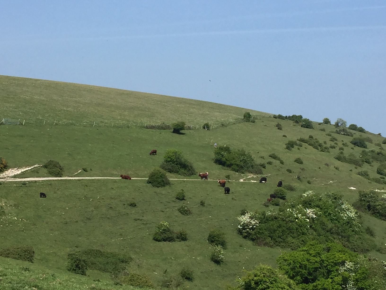
But you forgot that I have the photos as proof. Attached the pictures of the Dying Dane/ Brit from the top of Sullington Hill.
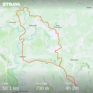
The flagging flying brit. 
The flagging Flying Brit 50.1km & 730m
-
RT.
I was out for a ride also.Perhaps suffering a little from excesses of VE Day celebrations, I decided on a short route (Clapham Woods and Cote Street). Avoiding Church Hill for this reason and because it has become a super-highway for pedestrians that it has now become, I went across the field just up from School Hill roundabout to the southern end of Collarbone Alley. I then headed south and across Long Furlong up to the track into Clapham Woods. Down to the A27 and west to Cote Street. At the top, after a stop to reflect both on the view and the many occasions of vox testiculorum undertaken there, I then headed south again to High Salvington, down Mill Lane and then north via the Gallops back to Findon.A refreshing peaceful ride with blue skies and almost no traffic on the A27.Total 8.84 miles and 773ft according to Strava.(8.64miles and 764ft Satmap)
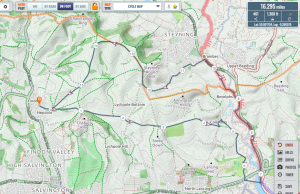
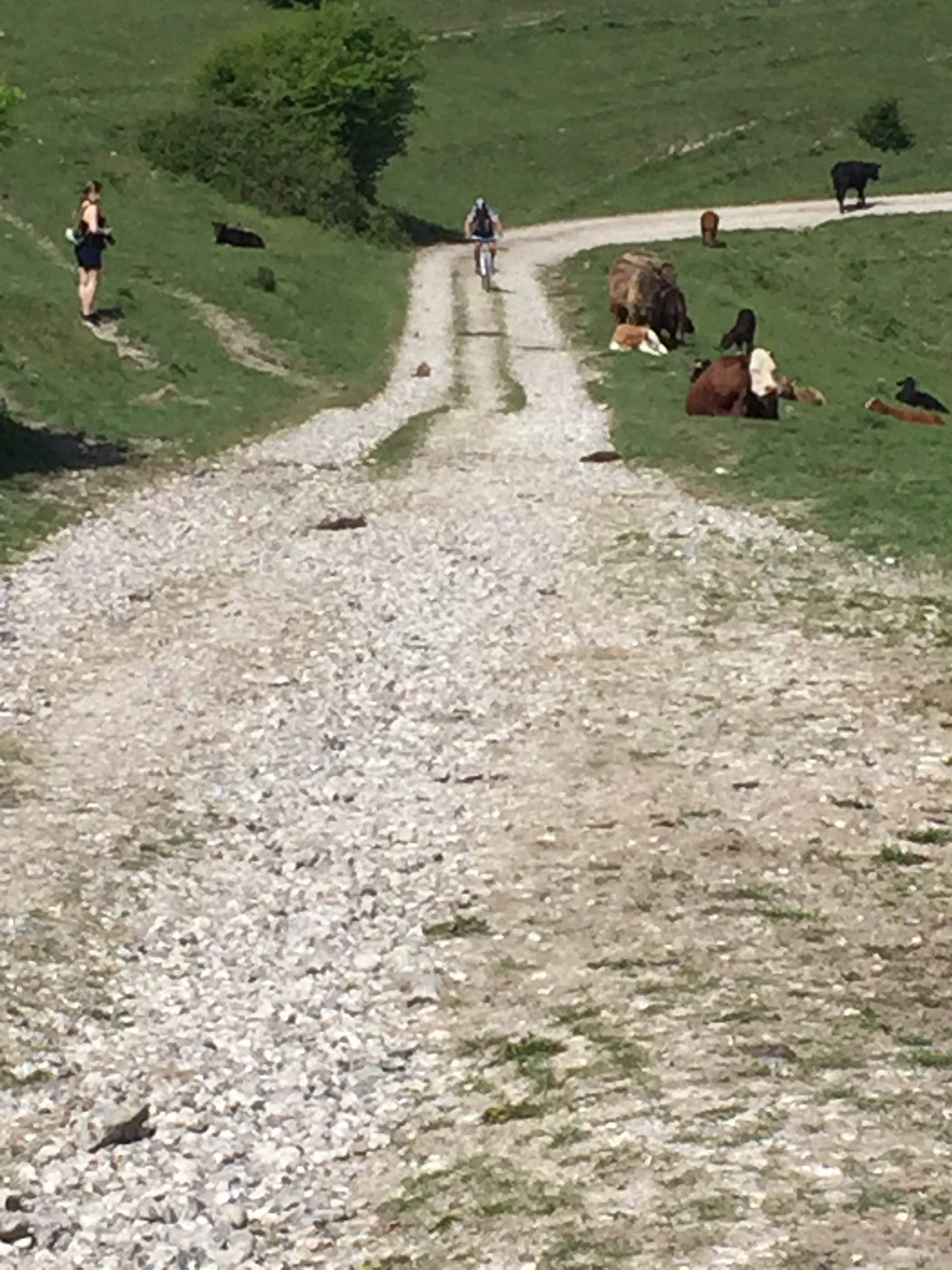
Richard’s route - ZA. Margaret & I were out: we encountered Chris in Nepcote Lane, en route to his not-rendezvous with Kim: we headed E. up past Cissbury Ring c/p, crossing the Sompting – Steyning Rd to take the track down to Church Farm at Coombes: followed Coombes Rd S. past Cuckoo Corner, crossing A27 to pause awhile at the E. end of Old Shoreham Bridge

Old Shoreham bridge ..From there we followed the Downslink up to Bramber Roundabout, Maudlyn Lane, Sopers Lane, the ‘Concrete Rd’ and thence up past the Langmead Memorial on to the SDW. We branched L. before jn SDW/‘Llama Lane down to jn at top of the Gallops, then thru the gate on the L crossing Gallops diagonally down to Nepcote Green. Device on M’s eSteed recorded this as 26.5kms (c.16.6 mls); we were out for c. 2hrs 30 mins: once again, it was a gloriously sunny morning, a joy to be out (as many other people running, cycling, walking or on horseback were also discovering …) (Satmap 16.295 miles and 1,368ft)
Zach’s route - AM.To the seafront via A24, A27, A24. Seafront Ride to Shoreham Fort/Shoreham Harbour.
Retraced route back to Worthing then along seafront to Ferring. Up Sea Lane and home via Goring, Durrington, and Findon Valley. Beautiful day sparkling sea and lungfuls of ozone. My Cateye said 26.2 miles.
- MA. I had a fancy to enjoy the sea (as I see Mr Mead did as well) so I followed the now usual Rustington-Littlehampton-Climping Beach route then continued along the much cycled footpath along the coast to Elmer where I stopped for some refreshment

Elmer then followed along the coast as much as I was able; only a short inland diversion through part of Middleton; along to Bognor where I paused to watch a small school of Dolphins feeding off shore, brilliant.
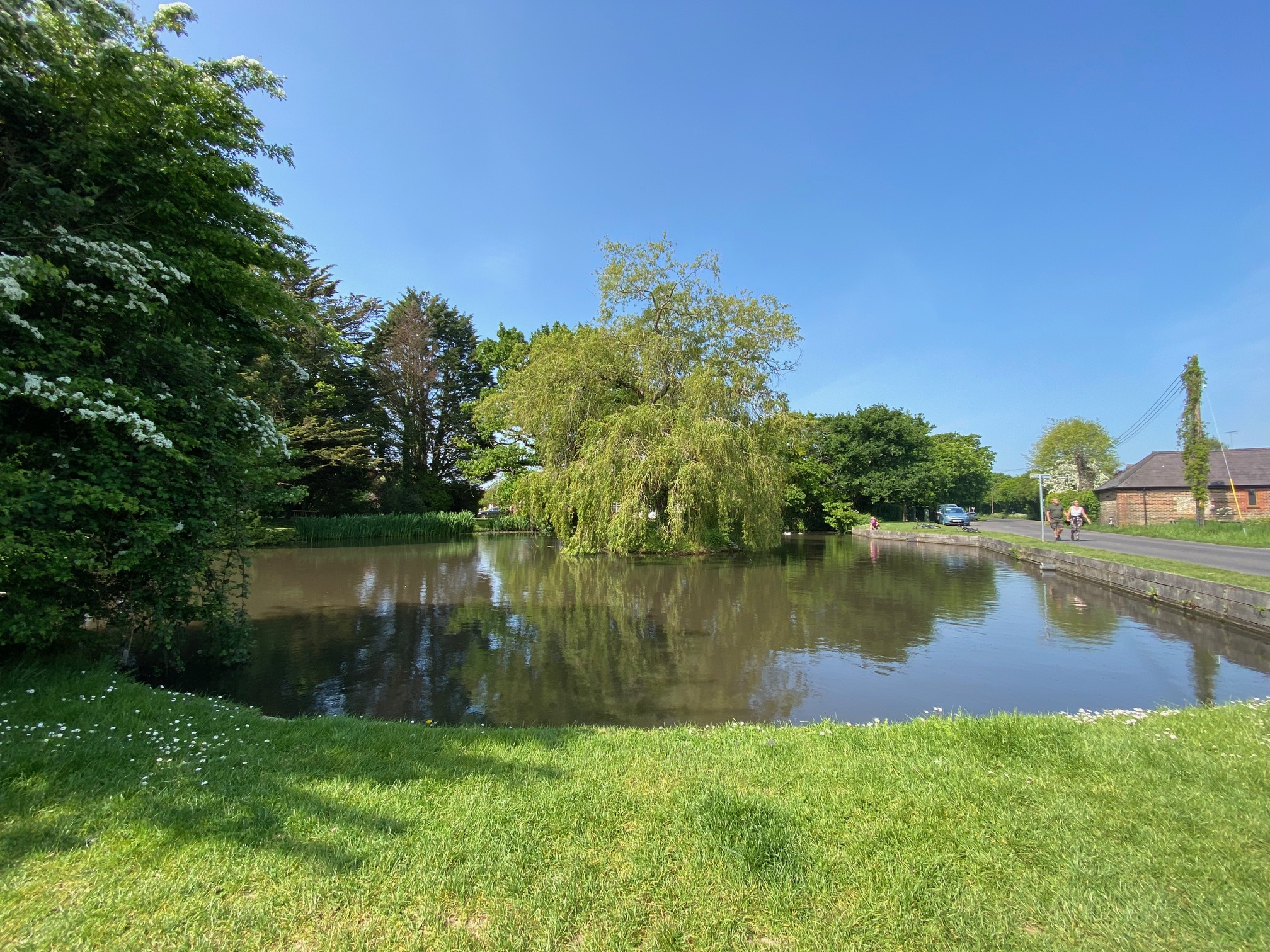
I kept going as far along the seafront as even Kim would manage before turning inland through North Berstead, Colworth, Oving, Nyton and Walberton where I paused again for refreshment .
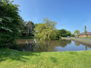
Walberton Pond I took the Old Scotland Lane path (again) towards Arundel with a plan to head off into the Downs thereafter to get a bit more off road cycling in.
However, receiving messages from family suggesting I meet up with them as they took their daily walking exercise, when I reached the Arundel/Ford road I turned South rather than North and cycled down to Climping Beach again; with a pause to admire St Andrews-by-the-ford church,
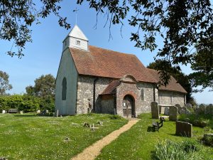
St Andrew by the Ford whereupon I did indeed meet up with the family, partook of more refreshment and then cycled home basically following the outbound route.
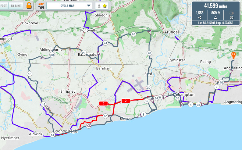
My app says 43.1 miles but only 209ft ascent. What a day! (Satmap 41.6 miles and 869ft).
Mark’s route - JB. 11.4 miles & 1,129ft.

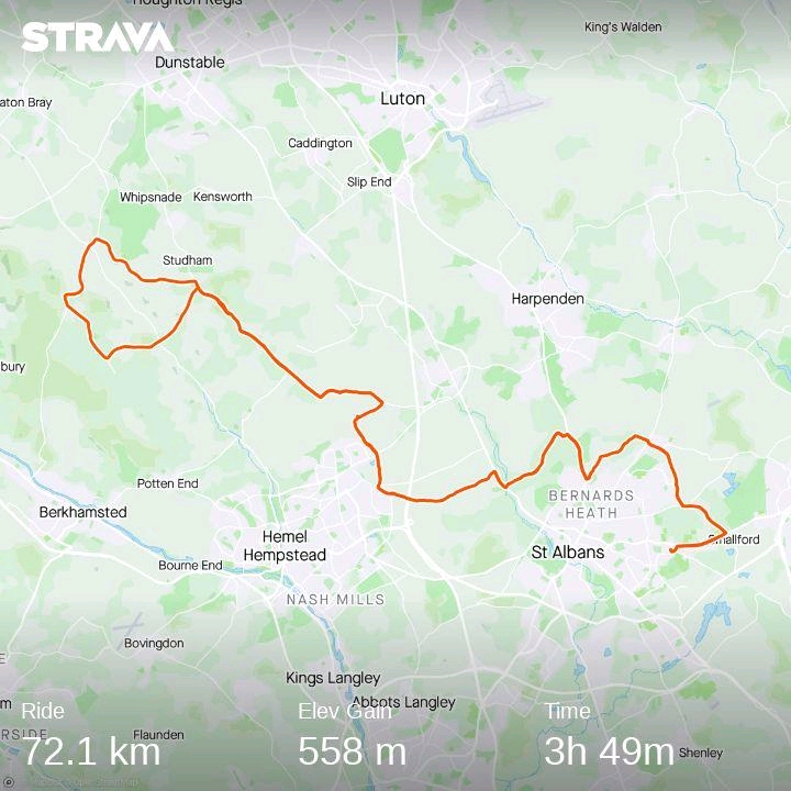
Jake’s route - RK. 72.1km & 558m
Roy’s route


Saturday 16th May 08.00am ride
ZA, MA, PT, CB, TK, RT, KBS.
- ZA. ->Worthing seafront via Findon Valley (where I encountered Mrs Budd out running in the opposite direction) Offington Lane, W Worthing level crossing, Downview Rd, Grand Avenue; inspired by Andy, rode E as far as Shoreham Fort. Thence back to cycle/footbridge across the R Adur and to Truffles for a coffee + pastry (as Chris had done on a previous ride) . West St, Swiss garden, Hebe Rd to Old Bridge and then back via Lancing College, Lancing Ring and Cissbury. Plotaroute total 19.24miles and 955ft.
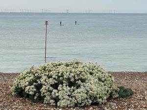
Zach’s route Spotted an egret on Widewater Lagoon where there are display boards with information about wildlife given in memory of my aunt & uncle. Couldn’t get near enough to get a photo with phone camera – image attached from the Web.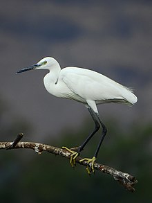
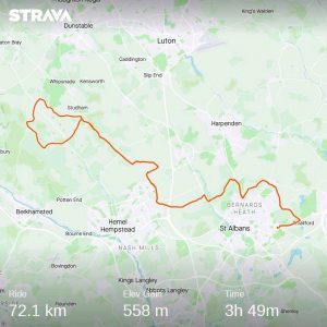
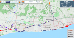
- MA. Tempted by Andy’s ride last week I dropped down to the seafront at Sea Lane cafe via Ilex Way then along the seafront to Shoreham Fort. From there I crossed the bridge into Shoreham and headed to Truffles for a coffee. Met with a large queue however, I ventured further towards the station and purchased a coffee from another little shop instead.After refreshing myself, I set off up Mill Hill over A 27 to Upper Beeding carpark where the SDW arrives after the climb up from the A283. I dropped down past Golding Barn Farm (an outrageous bridleway!) and then for old times sake over Windmill HIll and down into Upper Beeding and long to the Downlink. Down that and over the bridge through the airport and back to the seafront to follow the outbound route home. A lovely ride only missing fellow member companionship. Total 36.6 miles and 533ft. Plotaroute total 36.6miles & 1,204ft.
Mark’s route 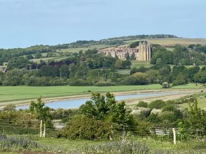
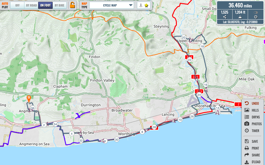
- PT. On this brisk morning I exited Horsham eastward via the St Leonards Forest, and headed down through Mannings Heath and Monks Gate to take the road south through NutfieldPassing through Maplehurst I took a bridleway through Joles farm to join the Downslink just north of the A272. Through a quiet Southwater, to take the road over the A24 then left on to Pedlar’s Way (appropriate) for an off-road re-entry into Horsham. Total 14.96 miles and 482 feet by SatMap, but 14.94 and 794 by Plotaroute. To keep the stats consistent (and gain more Everests) I am taking the Plotaroute figures!
Paul’s route - CB.
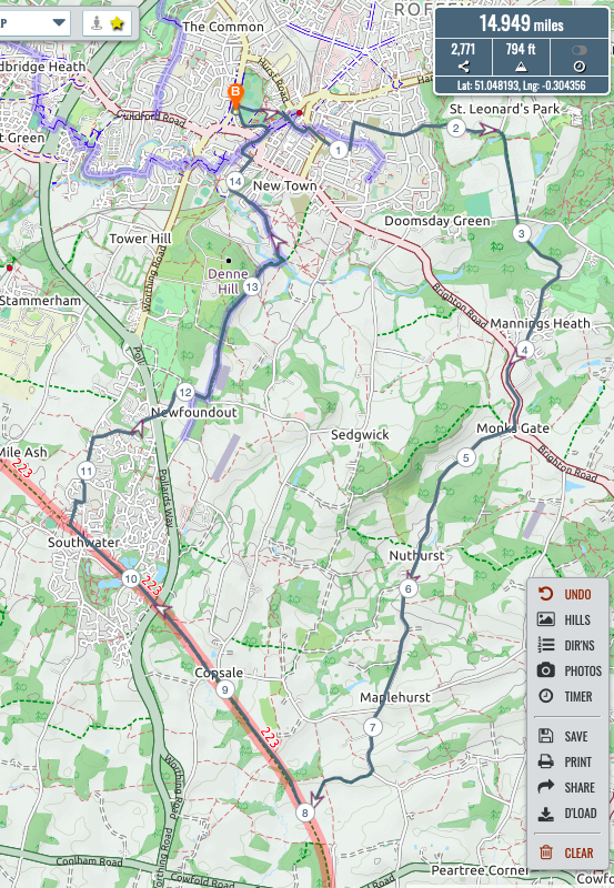
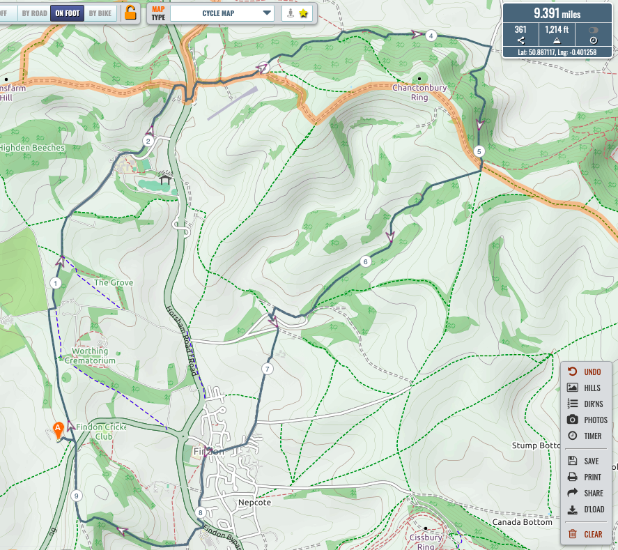
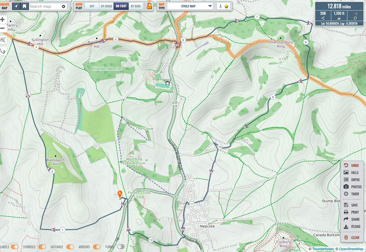
A shorter ride for me this morning and Strava let me down so no plot. But leaving Nepfield I headed up the road to Cissbury, taking the path around the west and then south of Cissbury and then the goat trail down and through Canada Bottom and the farm. Climbing back up on the gravel and cinder track to the Langmead memorial and on to Chanctonbury – marvellous views this morning and I met two ladies who were very pleased to be running together again for the first time in 8 weeks – gossi-joggers Richard?From Chanctonbury I carried on the Southdowns’ way whereupon I met Mr Kersley with his then powerless personal trainer (Clare’s staff hadn’t charged the battery so she was on the manual). To the A24 and then up to Windlesham, over the first field at the top and then down through the woods to the east of Muntham farmhouse (avoiding many places obstacles) to the gun club lane and climbing back up again to Puckamuck and then on to Church Hill. Down the drop and around the village on the a24 footpath to then climb up the bridleway to the lane that leads back to Stable lane. Up Stable lane and around the back of the stables to return to nepfield. My trusty old school device suggested about 15 miles – I look forward to the true reckoning from Plotaroute.
So dry out there now that it takes no time to get anywhere! Plotaroute total 16.8miles & 1,932ft.

Chris’s route - TK.
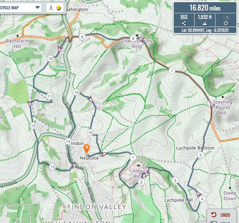
This mornings ride out , was as noted by Mr Budd , less e-powered .. as one e-bike u/s and the other with flat battery forced Claire to revert to a conventional steedThe route ..Up steep lane to green and onto Cissbury car park , to Chanctonbury circling this and returning on SDW east where we met Mr Budd ,
Proceeded from SDW to buddington bottom , gallops farm to Findon , extended route took us down A24 to join gallops at bost hill, to bottom of mill lane , up mill lane to windmill and return home to Findon via bost hill and A24. Plotaroute total 16.8miles & 1,932ft.

Tim’s route Rest of day spent cleaning / fixing and recharging steeds – all now roadworthy and ready for tomorrow’s ride . - RT.
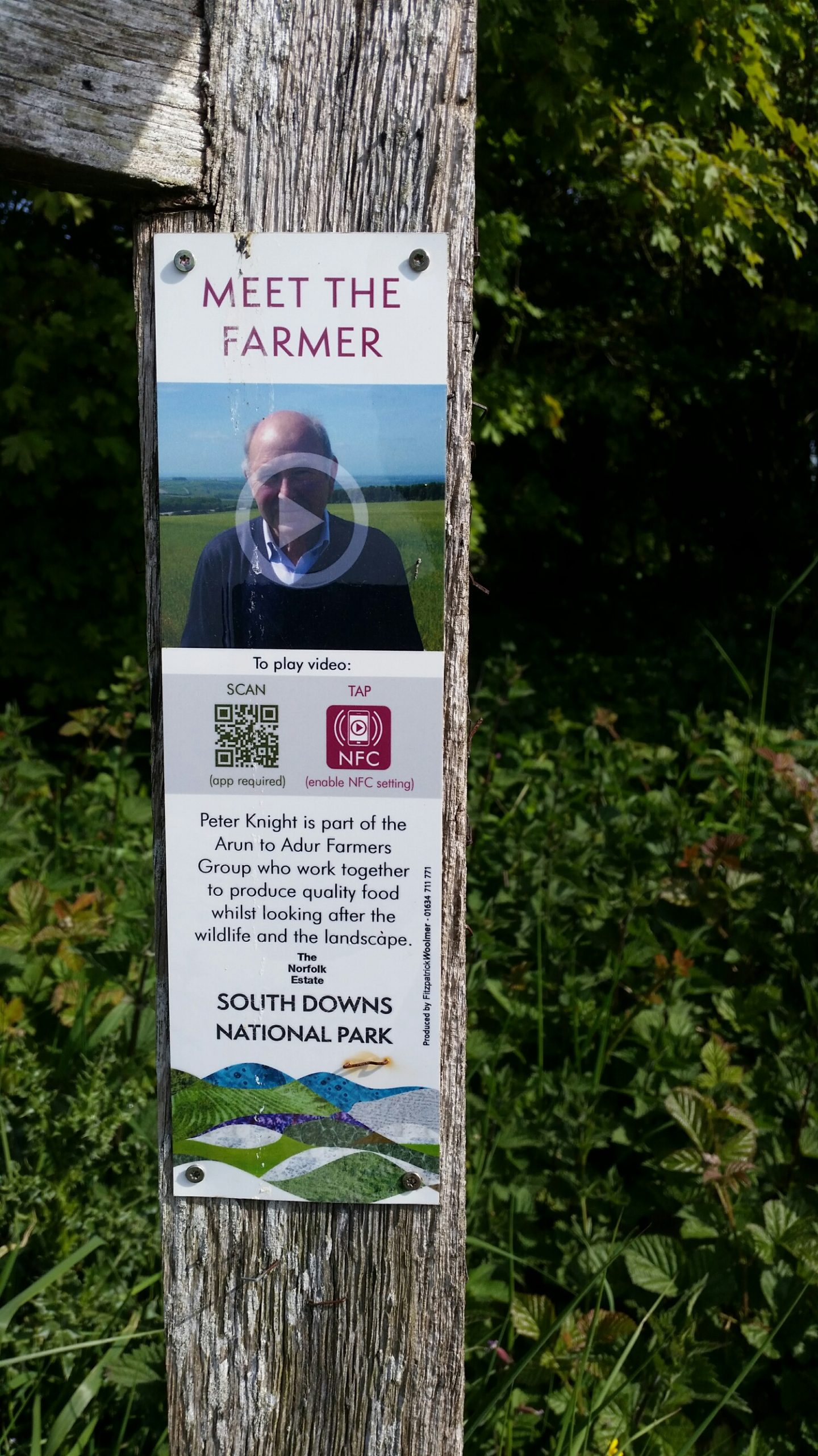
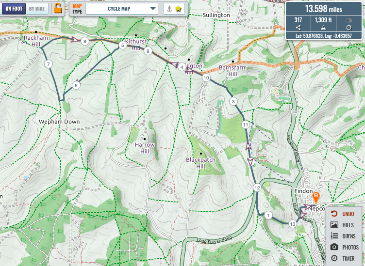
For my ride I wanted to undertake a bit of research for the proposed tank memorial. The question had been raised as to whether we should try to gain the permission of the farmer for the memorial before installing it and so I wanted to try to find out who is the farmer – there are quite a few “meet the farmer” signs around.In the meantime are we all agreed that permission should be sought?Route was Church Hill and the usual route up to the tank from there. At Chantry Lane the signs indicate that the land to the west is all part of Angmering Park Estate. Riding on to the gate for the track down to the tank site, but no information there. Down to the tank through the jungle as previously reported by Mr Budd to take a photo of the possible location of a memorial – I suggest alongside the track to the right of the photo between the track and the fence..
 From there I proceeded west across the two fields to KBS’s “vroom” track. The gate sign at this point indicates that the adjacent land just crossed is part of APE, but how far towards the tank?Then went up the “vroom” track to the bridlepath up from Burpham and then right up to Kithurst Hill and onto the SDW. At Kithurst car park there is a “meet the farmer” sign on the car park side of the track, a Mr Peter Knight, so I assume that he is the person we would need to contact if we are going to do so.
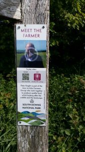 Return home directly via Church Hill again.
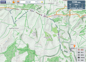
Richard’s route Bike repairs started at home – replacement of cassette and chain – only to discover a broken spoke which requires special tooling. DT Swiss (!!!!!!) giving me problems.Strava stats : 13.7 miles and 1,303 ft. Plotaroute total 13.6 miles & 1,309ft. - JB. PT comments:
Glad to see Jake was hurtling round his by now well-worn circuit, perhaps leaving slightly deeper tracks due to the increased pie consumption. Plotaroute total 11.4 miles & 1,129ft
Jake’s well worn track - KBS. I was out yesterday, too. Once again with my personal trainer. We went our usual way up towards Southdowns Way via Windlesham, crossed a now busier A24 to climb Chanctonbury. The car park at the bottom is now open again. After the first hill from the car park we made a turn to the left and after a few miles bridle way we reached the bottom of Lama lane which we slowly began to climb. At the top we took the bridle way to the right and raced down to Buddington Valley. Passed the farm and took the steep climb up to Gallop farm. Down to and through Findon and back home via Church hill. Wonderful ride. Plotaroute total 9.4miles & 1,214ft.

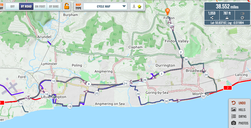
Kim’s route - AM. A24 to Thomas a Becket lights. A259 to Clymping.Down to Clymping Beach then back up to A259 towards Littlehampton. Down to West Beach back along LA seafront to Rustington, through East Preston, Ferring and along seafront to East Worthing. Back up to A27 along to Offington Roundabout up A24, to Findon and home. Cateye says 34.7 miles. SW wind a bit fresh and chilly. A lot more cars on the roads today. Good to hear the tyres singing on smooth tarmac though. Plotaroute total 38.6miles & 787ft.
Andy’s route.


Saturday 23rd May 08.00am ride
CB, ZA, RT, JB
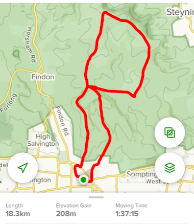
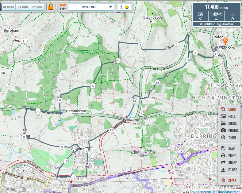
- CB. I decided to take Mark’s advice from Friday evening and head west to have the pleasure of the wind on my back on the return journey. As the map suggests I headed up Church Hill across to Tolmare and across the fields to Myrtle Grove. Climbing up to Angmering Park Woods and taking the bridleway heading across to join with Dover lane. From there I dropped down to a still pretty quiet A27 along the cycle path and down to the church and footpaths of Poling, I followed the footpaths across to Angmering hoping that I may find somewhere to buy a cup of tea.Nowhere selling tea in Angmering I thought to head to the shops by Angmering station to see whether there was tea to be had there – but again I drew a blank. Having given up on the hope of finding tea In the enviros of Angmering I decided it was time to start back towards Findon. I followed the old bridleway that now passes through Bramley Green passing close to my Gemma’s house. I followed down to water lane and along the bridleway which runs close to the main road and the underpass to patching. Footpath along the side of the world end pub in patching and up to Coldharbour lane. Across a still quiet long furlong and into Clapham. I continued to the church having mentally prepared myself to fight through the footpaths in Clapham Woods and take on any difficult land owned. I had a lovely cycle though Clapham Woods where I met no one. And then back to church hill which I was able to fly down without meeting any walkers for a change. Strava reports 29.27km and 410m of climb.Mainly warm and breezy. Total 17.4 miles and 1,424ft climbed.
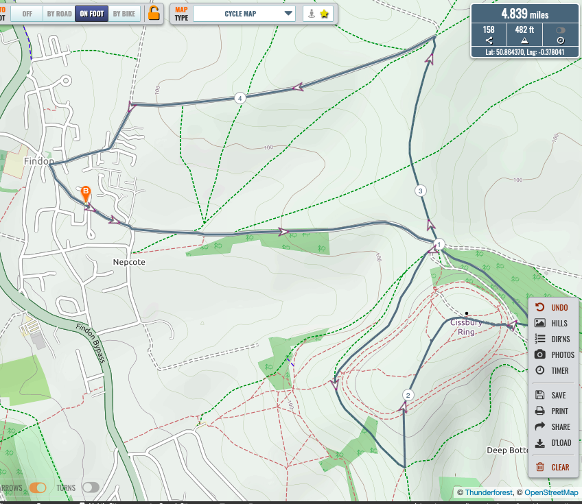
Chris’s route - ZA. A short ride up Cissbury round the west side, meeting Jake along the way, then up through the middle, having a dispute with an irishmen over his right to be riding there, then back down the east side and home, a short ride due to exhaustion from grandparenting duties. Plotaroute total 4.8 miles & 482 ft.
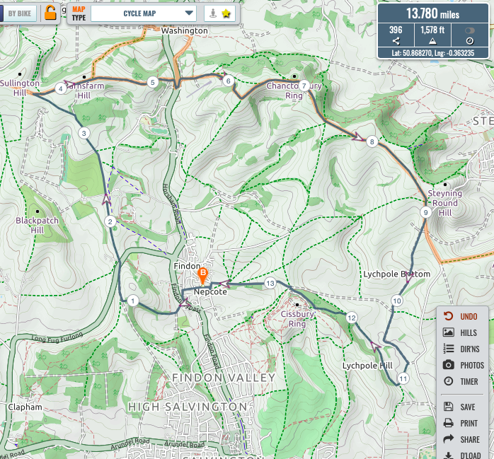
Zach’s route - RT.
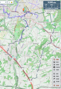
I again wanted to have a shortish ride so that I could get back to fit the wheel kindly provided by Mr Roche to the Stumpjumper, trusting that the large crack in Mr Topley’s old wheel would survive. Five peaks ride stating with Cissbury to the top via the upper east side track, down the goat trail and back to Langmead via Lytchpole farm and the gravel track. Then a struggle against the strong wind to Chanctonbury and down to and across the A24 at Washington. Up to High barn which was particularly hard going against the wind, but to then be blown back south to collarbone alley, Church hill and home.Replacement wheel fitted and working well – feels strange not to have a rear wheel wobbling as I ride along.Plotaroute total 13.8 miles and 1,578 ft.
- JB. Thought as a change I’ll do my usual course … Nice to have a quick chat with Zac on route … Very nearly succumbed to using my electric bike but I carried on with my analog for now…popped a few pill for back … Plotaroute total 11.3miles & 1,060ft climbed
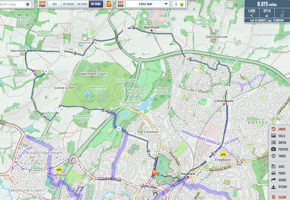
Jake’s route - PT. I was out for a short circular tour of Horsham, taking in Horsham Park, the three railway stations and then heading out to Warnham village (about a mile from Warnham station), then re-entering Horsham under the A24 and across the golf course to irritate the early golfers. At some point the first broken spoke for this bike was suffered, but was not discovered until arrival back at Farriers Court. Plotaroute total 9miles & 371ft. Footnote : Subsequent to the ride, Mr Topley went to Halfords to get his spoke replaced and, upon finding that the two in front (a father and son) were there to get a puncture fixed, TM’s fingers itched so much (possibly motivated also by the boredom of being in a long queue) and the puncture was repaired in the moving queue. They were spared the cost of the repair plus waiting and TM was one step further ahead in the queue. Shame about Halford’s profits.
Paul’s route - MA.A shorter ride for me as well this weekend, in part because I overslept and didn’t leave until nearly 08:30.Wishing to see the sea again I headed down to the front at Rustington then came back inland again and turned left to find a bridleway that goes through the middle past the sports ground (another one “crossed off the list” of bridleways within reasonable cycling distance of Angmering) then to the river, up through Wick, Lyminster to Poling, across the A27 and along the path through APE to the top of Swillage Lane then up to ridge above Lower Barpham Farm then down through Patching and home on the Old Arundel Road.A beautiful blustery day. Plotaroute total 17.4 miles and 725 ft.
Mark’s route - KBS. Rather late I can add (for the bling award) I too was out last Saturday (the other Sunday) on my trusted K2, however without my personal trainer due to the windy weather. For the same reason, I extended our usual loop and went west on the Monarch’s Way, turning right after the two first climbs and ended up on the Southdowns Way . There I met my neighbour on his way home. However I continued downhill to A24, crosssed it and climbed half way up to Chanctonbury hill and turned left to the bridleway to reach the bottom of Lhama Lane (and at the same time notice that the high gate into the hoarse farmer was OPEN). Not tempted to revisit the hoarse farmer I climbed Lhama lane (only using my middle ring) At the top I turned right down to Boddungton Bottom. At the end just after the gate – and the remains of the cottage where kids arrived bare-foodet to the local school – the path was blocked by a fallen tree. Easily overcome, I continued out in the open valley. Continued past the farm and turned left to climb the steep field up to Gallop Farm. Back home through Findon, crossing A24 for the second time (where I met Mr Roche on his way to the newly opened garden centre) Up Church hill (again only middle ring) and down Honeysuckle lane to Tolmare Farm Cottage (Home Sweet Home).

Kim’s route


TAMITS? MA stretching the 10 minute rule in lockdown?
PT puncturing Halford’s profits by fixing a “blasteet” in the moving queue.
Saturday 30th May 08.00am ride
AM, RK,CB, RT, MA, PT, TK, ZA, KBS, JB.
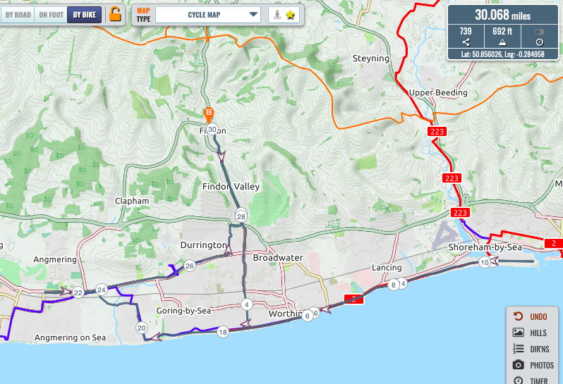
- AM. Once again dictated to by windspeed and direction went East. Straight down to Worthing seafront at the end of Heene Road. Eastwards into a stiff S. Easterly to Shoreham fort. Paused for a while to read the info boards and have a look round. Built in 1854 to keep Old Boney’s rabble at bay was equipped with guns with a range of 4 000 metres. Apparently it did the trick. Westward with a following wind via the sea front, Sea lane Ferring, the A259 to Rustington Sainsburys. Turned for home via Angmering on the A259 up Stone Lane across to the A24 and home. Beautiful day, sparkling sea but much busier roads. Cateye says 31.1 miles. Plotaroute 30.6miles & 692ft

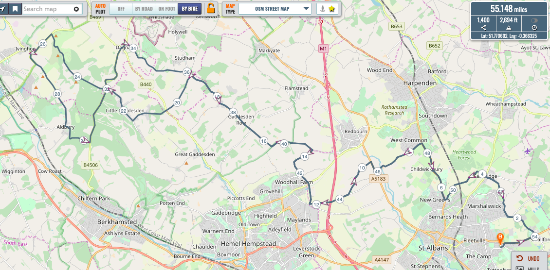
Andy’s route - RK. As with everyone else we had a very pleasant ride out. We made it to Ivanhoe Beacon where I reminisced about last year’s ride while eating an ice cream at the top. Plotaroute total 55.1miles & 2.694ft

Roy’s route - CB. Richard and I rode together yesterday and must have been within a cats whisker of bumping into you Andy in the coastal environs of Shoreham.
We left Findon on the A24 heading up to take the west face climb to Chanctonbury. Very beautiful views from Chanctonbury we continued on the SDW passing bacons hill all the way to its junction with Mill Lane (near Truleigh Hill). More fantastic views with the slight haze now lifted. A rapid decent to shoreham for bacon baguettes (not warmed Kim) and tea from Truffles. For the first time since lockdown the ‘usual’ lady server us in Truffles greeting Richard with an ‘oh it’s you’ and going on to comment that ‘he has far too much sauce without needing any on his bun’.
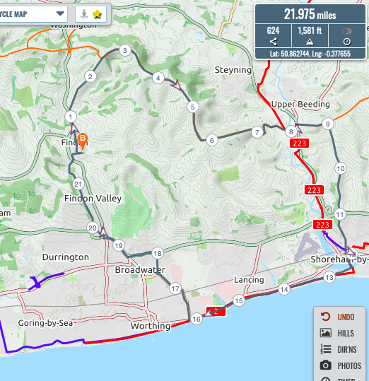
Refreshments consumed in the church yard we set off to the footbridge and followed the coast to the half brick. We turned up to cross the railway by east Worthing station and then headed through the housing estates to arrive at the A27. a27 to offington roundabout and then through durrington cemetery and onto mill lane, the gallops and back to Findon via Rogers Farm. Map and data attached. Plotaroute total 22miles & 1,581ft.
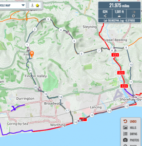
Chris & Richard’s route - RT. Just to add to Chris’s message, we debated whether to go on the Downslink or go up Truleigh hill. As I was hesitating at the prospect of such a climb he suggested that we take the SDW route rather than the route via Bramber because it is an “easier” climb. Persuaded but still doubting I agreed to go for the Truleigh Hill route. Needless to say but that the Italian stallion shot up the “easy” climb whilst I gasped my way to the junction with Mill Road having thoughts of possible need to call for an ambulance, arriving several minutes later. Not much energy left for the rest of the day, but a great ride. Plotaroute total 22miles & 1,581ft.
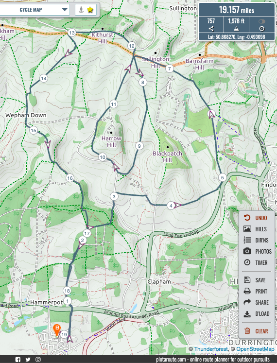
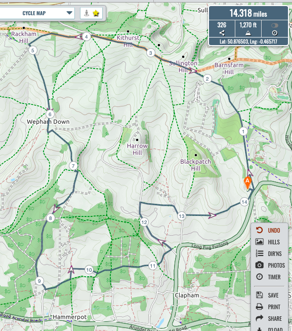
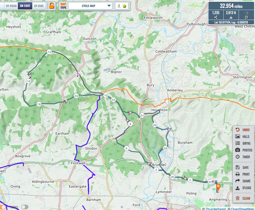
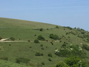
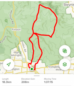
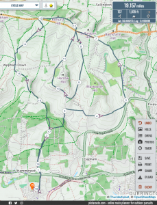
- MA. I planned a looping route amongst The Downs to continue my quest to travel along every bridleway within reasonable cycling distance form home. I took Dappers Lane/Swillage Lane to the Monarchs way to Tolmere Farm where I had the unexpected delight of meeting The Flying Brit and Rose who was out for a ride to celebrate completing an exam for her masters on Friday.NEWSFLASH – Kim reported that when out for their usual ride, Kirsten fell into a ravine while attempting to climb Llama Lane causing serious injury which required a visit to the hospital and she is now hobbling around on crutches. Get well soon Kirsten.Kim, Rose and I followed the same flightpath along the Chantry Post whereupon I dropped down towards Lee Farm then climbed back up again to the Post then started down the road and took the bridleway to the left that runs sort of parallel to the SDW as far as Kithurst car park. I took the route across the field to the not tank site and tried to ride the correct path through the copse but it is impassable so I went round the edge and dropped down acros the field to Wepham Down then over Barpham HIll and home through APE.Not very far at just under 20 miles but I did seem to climb a lot! Plotaroute total 19.2 miles & 1,978ft.
Mark’s route - PT. I took a shortish circuit on Saturday, climbing up an officially recognised bastard hill (as marked on the OS map) past Holbrook House to Rusper to visit the old stamping ground of the Team Chaplain, before looping round to Warnham and Broadbridge Heath. Keeping on the tarmac on a sunny day really reduces the need for bike washing! Plotaroute total 15.5 miles & 827ft.

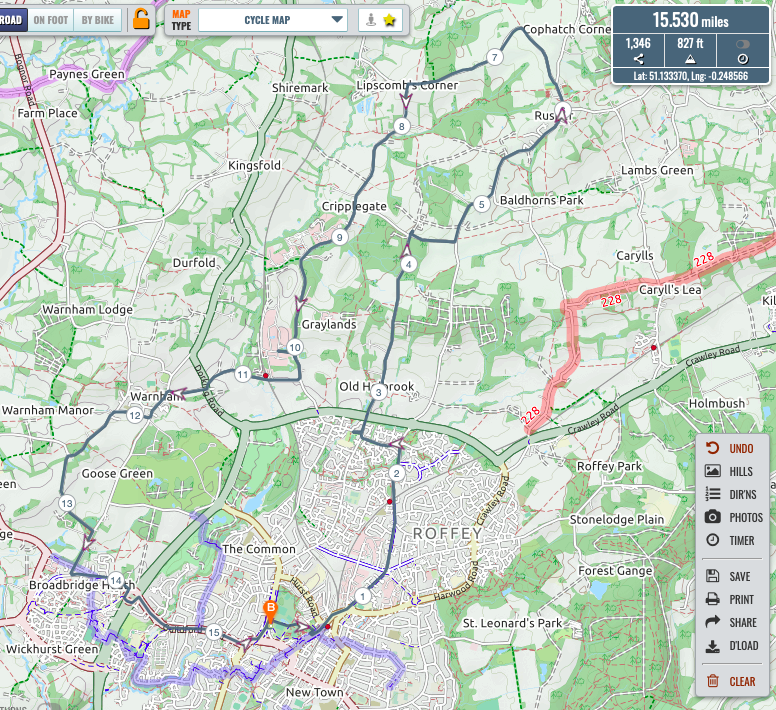
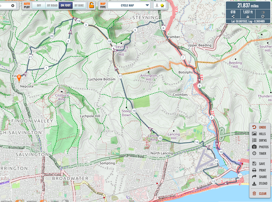
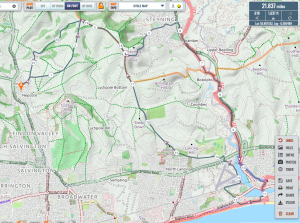
Paul’s route - TK.
I was also amidst those who passed by on shoreham beach, this time without any personal trainersI left Findon up to cisbury car park , turning left climbing towards chanctonbury at South Downs way I changed my plan and headed east to langmead and top of concrete track, again changing plan Heading back across Steyning bowl and down the steeper bostal route to Steyning passing the white horse and church before crossing the bypass and meeting the end of Roman road, heading south to join downslink all the way to shoreham , progressing into town , past truffles and church, over the footbridge onto shoreham beach- ( missing messrs Mead / Thomas / Budd ) then to widewater diverting back to shoreham airport , lancing college , lancing clump continuing straight on to repass Steyning bowl and langmead , SDW, buddington bottom , gallops farm and home .. great weather. Plotaroute total 21.8 miles & 1,637ft
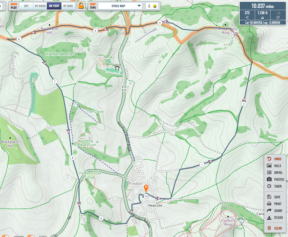
Tim’s route - ZA. Having had energy sufficient last Sat only for Cissbury Ring, set out to attempt remaining 3 of the 4 Peaks – which is what I did .. Turned L off lane at top of Nepcote Green to take diagonal bridle way emerging on to familiar track heading E from Downs Stables nr Mill House: thence usual route up to Chanctonbury, thence SDW W to The Barn, back down W of Muntham to cross Long Furlong, up Church Hill, returning via Rogers Fm, High St, Steep Lane, Cross Lane,Southview Rd .. Slowest 3 peaks ever having taken time for a.m. devotions, to ‘smell the roses’, and enjoy a conversation with a walker (yes, I rode THAT slowly!) ascending Sullington Hill … 2hrs 30 mins. Plotaroute total 10 miles & 1,138ft.

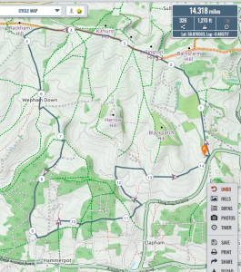
Zach’s route Full many a glorious morning have I seene,Flatter the mountaine tops with soveraine eie,Kissing the golden face the meddowes greene; - KBS.With a new personal trainer I set out yesterday at 8:15am and just when we had climbed our drive, we saw a rider come shooting up from Monarch’s Way. To my surprise it was Mr Avery who had to stop after his quick arrival to check his breathing.
Mr Avery was on a mission: riding on all bridleways in the area and would complete it today. We joined him on our the way to Southdowns Way until we separated at Kithurst where Mark went south and we continued on Southdowns Way. At the Brooom bridleway we turned left and continued downhill. At the end we climbed the field that was full of sheep and lambs.At the top we turned right to reach that days second Brooom bridleway. Downhill again ending in the southwest corner of APE. Here we took the bluebell route, turned right again and deeper into APE until we took a left and a left, passed the Dover car park, took the footpath and at the end we took another left to another overgrowed footpath. We ended on the bridleway leading out of APE. Back home via Myrtlegrove and Monarch’s Way. Plotaroute total 14.3 miles & 1,270ft.
Kim’s route - JB.?